Category Archives: campsites

The unveiling of the U.S. Civil Rights Trail

This was a part of our recent travels. Our article on the “new” U.S. Civil Rights Trail is in the current issue of Canadian RVing magazine, a great publication we’ve started writing for on a regular basis. Really enjoying working with this fine people in the publishing world.

Read it here: U.S. Civil Rights Trail

Civil Rights, long stretches of beach and a whole lot of writing

Sometimes that “what should I write about?” falls right into your lap.

While travelling, we got a heads up through a work email that January 15 (Martin Luther King Jr. Day) was to be the launch of the brand new United States Civil Rights Trail. Took us about five seconds to make a decision, tap the new coordinates into our GPS and follow the two-hour detour to Greensboro, North Carolina.


Greensboro was home to the first student lunch counter sit-ins, an action that (according to MLK) gave the Civil Rights movement “a much needed shot in the arm.” That very first lunch counter sit in was held on February 1, 1960 by four young students from A&T University (Jesse Jackson’s alma mater). The stop on the new Civil Rights Trail is at the original F.W. Woolworth’s building, the site of the lunch counter sit-in. Now it is the home of the International Civil Rights Center & Museum. The museum is a worthwhile stop on its own, but the highlight is definitely the completely restored lunch counter. It’s a sombre, but inspiring sight.

Craving some ocean waves, we drove southeast to our first week of camping at Huntington Beach State Park, about 20 miles south of Myrtle Beach. Great park (surprisingly, about 80% full), nice long stretch of beach, wonderful marshland boardwalks. We did detour into MB for an excellent lunch at Croissant’s Bistro & Bakery (shrimp and grits, chicken and waffles, with a shared slice of key lime pie).

It turned out to be almost a full week of catching up on writing assignments at the lovely Waccamaw Neck Public Library. Can’t end this update without a thank you to Luke from Georgetown Auto Glass whose mobile service came and quickly stopped two windshield chips. Thanks Luke!

Finding more blues outside the Mississippi Delta

If ever there was a pretty Southern town, it has to be Natchez, Mississippi. So, we parked ourselves there for three days, worked in the library, walked the streets and stopped in for coffee often at the excellent Steampunk Coffee Roasters. Next door is the historic blues club the historic blues club named Smoot’s Grocery. Smoot’s has received a top-to-bottom renovation and is a beautiful space for parties, get-togethers or live music. Well worth checking out if you find yourself in Natchez.


Our schedule included a “break week” when we were taking some down time on the Mississippi Gulf Cost, catching up on blues-related reading, working on the book structure and starting some chapter work. All accomplished while we stayed at Gulf Islands National Seashore near the pretty town of Ocean Springs. While there we crossed paths with a get together of about two-dozen Roadtreks and we were quickly welcomed into the fold. Thanks y’all! Looking forward to the next time.

Back to work and starting the drive northward. Our first stop was in historic Meridian (the home of The Father of Country Music, Jimmy Rogers) where we had a fascinating hour interviewing Hartley Peavey, the founder of Peavey Electronics. As a teenager he started building amps at his parents place and he is now head of a worldwide corporation producing quality musical sound systems and instruments.

On to the small town of West Point, considered the home of Howlin’ Wolf. There’s a blues marker, a small but very good museum and a very cool downtown mural.

Just a bit further into the northeast corner of Mississippi – we stopped at Tupelo. Tupelo is the hometown of Elvis Presley. He was born there and lived in East Tupelo with his parents until he was 13 years old and they moved to Memphis. They’ve done a beautiful job at the Elvis Birthplace Museum, the self-guided driving tour, at Johnnie’s Drive-In (where they have preserved an Elvis booth where he’d hang out with friends and order an RC cola and burger) and at the Tupelo Hardware, the spot his mother bought him his first guitar. Probably the best $7.75 she ever spent!

Very photogenic: Black Canyon of the Gunnison National Park

Black Canyon of the Gunnison AND the biggest RV you’ve ever seen!

bc13

Admission time: Before we got to this point in our trip, we didn’t know anything about the Black Gunnison in Colorado. We hadn’t fully researched the stop yet and thought it might be a battle site or some sort of historic marker. Well, were we ever off the mark.

Black Canyon of the Gunnison is a national park showcasing an extraordinary demonstration of the power of water to sculpt a landscape (yes, more rocks!). In this case we are talking about the Gunnison River (nicknamed the “Gunny”) but the rocks here are very different from anything we’d seen in Utah, Wyoming or Colorado. This dark grey schist and gneiss are the “basement rocks” of the Precambrian-era. Think really old. Think rocks that are very, very hard and resistant to the erosive effects of water and wind. Think: Black Canyon. Now the name makes sense.

bc16

These are the oldest and hardest rocks in North America. The canyon is narrow and very deep (the site of Colorado’s highest cliff faces – the Empire State Building would barely crack the halfway mark). The deep canyon was carved by the river over a period of two-million-years and exposes two-billion years of geology. The rock is so tough that one year of erosion wears away the equivalent of the width of a human hair.

The park itself is on a remote plateau at an elevation of around 2,400 metres. The air is thin and the vegetation is mainly scrub oak and some stunted fir trees. We camped at the wonderful national park campground and were treated to another star-filled night with a sliver of a new moon in the very early morning. The Milky Way was on full display. This park is an International Dark Sky Park.

There’s a scenic drive along the rim road with all kinds of pullouts and short hikes down to the edge. However, our favourite viewpoints were on our early morning hike along the twisty Rim Trail. The two-mile hike was quiet (this park is also blessedly free of crowds), the air was crisp and fragrant, and we stopped and watched the birds swirling and swooping deep into the canyon.

bc19

On the way back from our hike we were taken aback by an enormous white “garbage truck” pulling into one of the scenic lookouts. This seemed very out of place to us – until we took a closer look and noticed the EU licence plate, the Swiss flag decals on the front and the two people who hopped down from the cab (definitely not sanitation workers!). And that is how we came to meet Elisabeth and Kurt, two early retirees from Switzerland who have been travelling for three years in their custom-built motorhome/RV.

“RV on steroids” jumped to mind. Their home on wheels appears to be an adapted armoured personnel carrier on a Mercedes-Benz platform: 450-litre diesel fuel tank, 800-litre water tank, a huge bank of batteries (that must weigh a ton) and an array of solar panels. Their solar has been so efficient that they’ve hardly had to turn on the generator.

bc14

We felt like road trip pikers next to Elisabeth and Kurt. They shipped their RV from Hamburg to Buenos Aires three years ago and have been travelling South America from top to bottom, all through Central America, and for the next 13 months will be exploring the U.S. (including a side trip up to Alaska) and Canada before shipping their motorhome back to Europe from Halifax. We exchanged contact information as well as an open invitation to stay at our place when they pass through southern Ontario. We hope they do – if and when it happens we will invite all our friends and throw them a welcome party filled with food and friends and music. Everyone we know will want to hear all about their inspirational travels. So – Elisabeth and Kurt … don’t forget our invite!!

For more photos: click here.

www.nps.gov/blca/index.htm

www.colorado.com

www.visittheusa.ca

Spoiler alert: We loved Ouray!

Spoiler alert: We loved Ouray (pronounced U-RAY).

What’s not to like? A clean, friendly, authentic western mountain town, tucked in a narrow valley with craggy, granite rocks on one side and snow-capped peaks on the other.

o3

This is a former gold and silver mining area, but once mining went belly up (more or less), they reinvented themselves into a funky, small (population 1,000) getaway spot carved into the western slopes of the Rockies.

The setting, the old mining roads and the cliffs (a rock climber’s dream) attract all sorts of people scrambling around on trails, scaling rock faces (winter and summer), mountain biking and trying not to collide with mountain sheep. There isn’t a flat surface here – and that includes the historic Main Street lined with small, independent shops (not a single chain or franchise in the whole place).

Ouray is encircled by a well maintained hiking trail about 10 km in length, with all sorts of short trail spurs branching off. We were able to get in an afternoon hike – leashed dogs okay – with excellent views up to the surrounding mountains. This is bear country (didn’t see any) as well as deer and fox (when we found our campground we were warned of a fox that likes to steal shoes left outside … a Shoe Chick Fox).

o9

And we haven’t even mentioned the natural thermal hot springs (without sulphur) that make Ouray famous. In the name of research, we dipped into the two main ones in town.

The downtown Ouray Hot Springs is 75 years old and has just closed for a major renovation (reopening May 2017 – we were actually bobbing about in the hottest pool mere hours before they closed for the renovation). Forget meeting at the local bar for a TGIF get together. These pools were filled with boomer-age locals, who donned suits and hung out in the water while catching up on each other’s lives.

It was the perfect way to end a great day in a great little town. We camped at the splendid National Forest campsite perched above town – Amphitheater Campground. Small, no services at all, perfect little sites and dark, dark, dark at night so we got a real show of the stars and constellations.

o10

The next morning, we had to (sadly) leave Ouray. Next time we’ll build in more time here – the town is halfway between Grand Junction (and the Colorado National Monument) and Durango to the south. So, to take some of the sting out of leaving, we spent the morning at Orvis Hot Springs, another set of thermal pools just north of town.

Orvis Hot Springs is beautifully laid out – lots of little pathways and shrubbery separating meditative spaces, clusters of Adirondack chairs and about a half-dozen unique thermal pools (different in terms of size, shape and temperature). Our favourite was the hottest one called the Lobster Pot (112F). There is a definite hippy-dippy vibe – the indoor bulletin board is plastered with notices for yoga, dog-sitting collectives, astrology readings, etc.. There are even some clothing optional pools. (You can ask. We may or may not tell.)

www.ouraycolorado.com 

www.colorado.com

www.visittheusa.ca

Talk about a drop off the cliff!

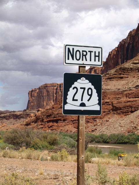
The U.S. National Park Service is made up of many different types of sites. Two of the most common are National Parks and National Monuments, which are often confused. The parks have been protected for eternity by an act of Congress; monuments have been created by presidential proclamation. It doesn’t mean that there is an obelisk or statue at the latter. It’s a common misconception – the park ranger at Colorado National Monument near Grand Junction, CO told us the oddest question he gets is, “Where is the monument?”

grj4

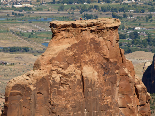
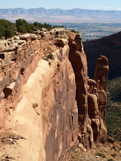
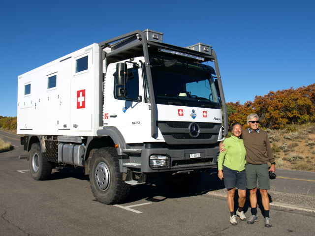
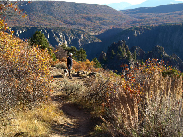
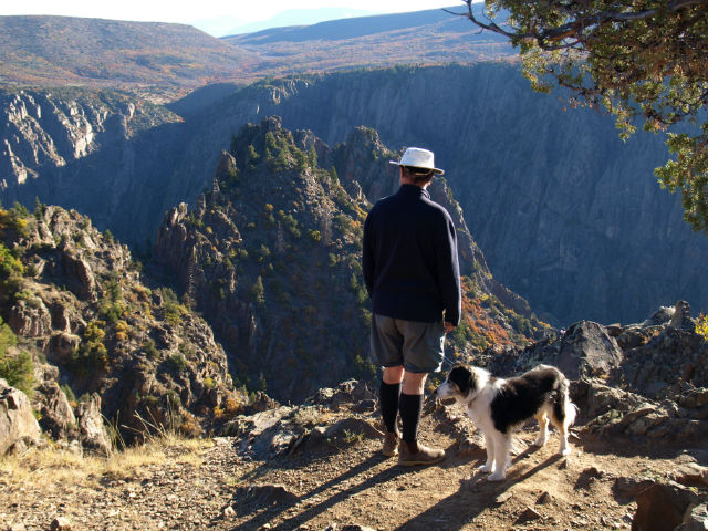
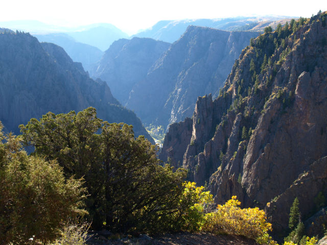
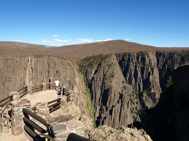
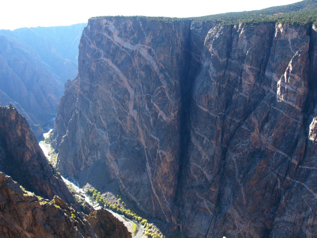
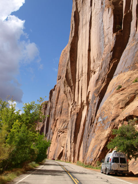
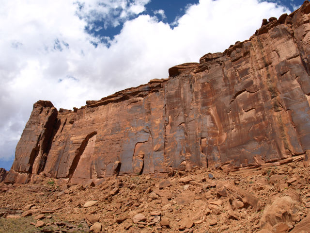
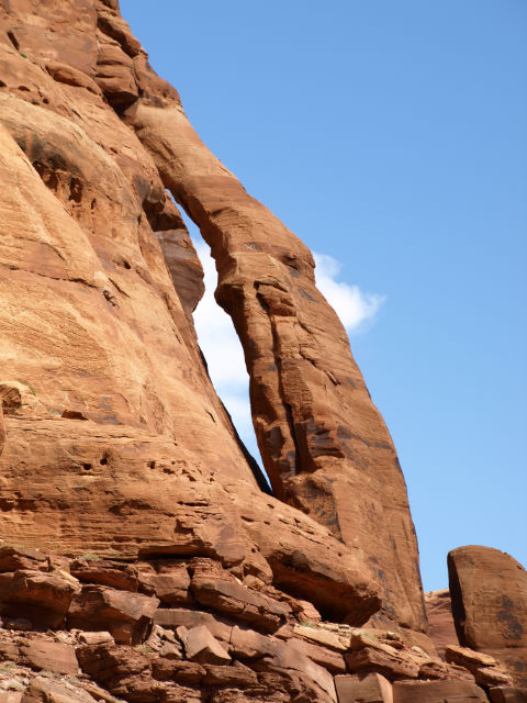
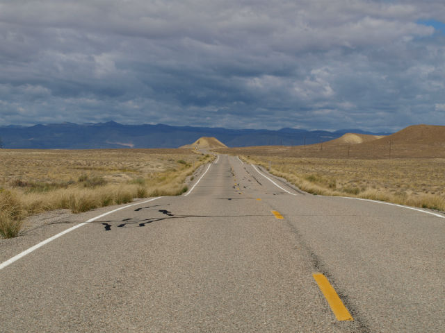
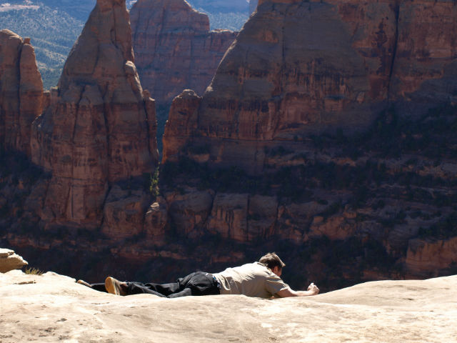
Well, the whole park at Colorado National Monument is the monument. There was little in the valley communities below to prepare us for the jaw-dropping scenery along the 23-mile, Rim Rock Drive following the park’s exposed ridge. Craig – ever the boundary pusher – bellied up to the cliff edge to get photos. I did a mental update on our life insurance policies.

grj8

A highlight for us was actually inside, at the Visitor Center where the excellent short film was full of ah-ha moments about the geology of the entire Colorado Plateau. It’s available on YouTube and shouldn’t be missed if you are heading west (and especially if you are a bit of a Geology Geek).

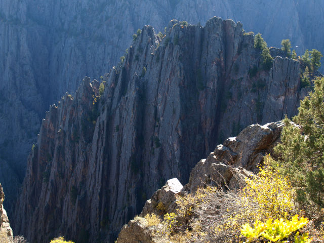
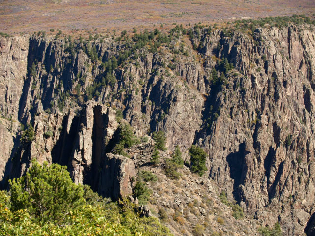
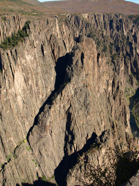
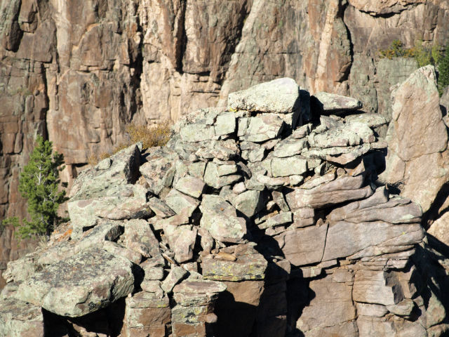
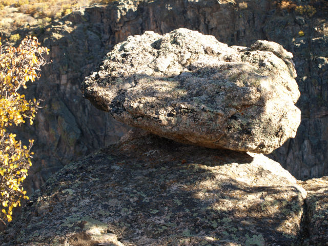
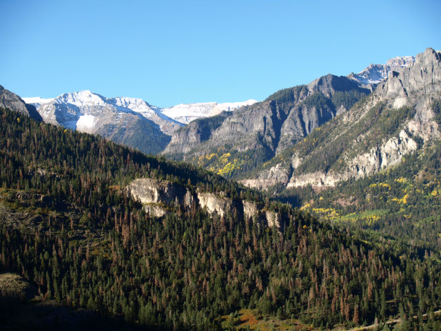
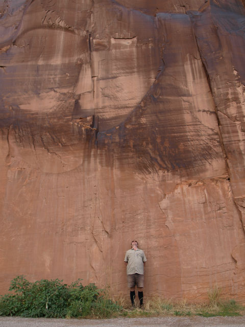
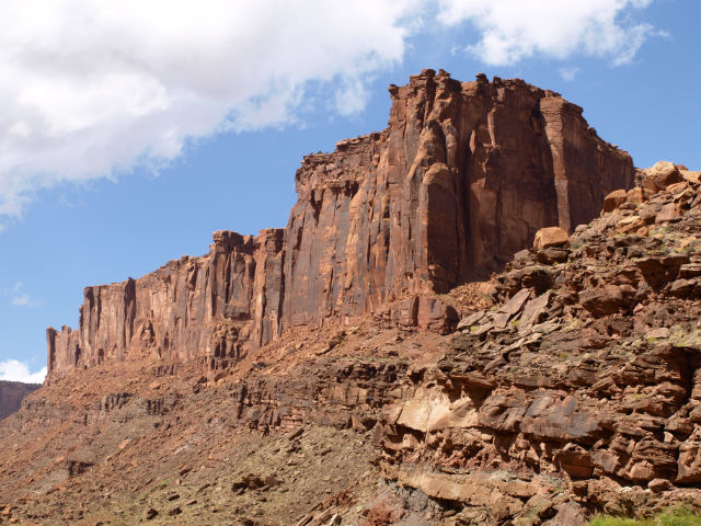
In a nutshell, 80 million years ago, this area was flat. Between 70 and 40 million years ago, moderately-strong earthquakes along the visible Redlands Fault created the tilt and shift in huge layers of rock, forming basins and uplifts. The faultline runs right through the park and we crisscrossed it several times – the erosion of the last 10 million years has exposed the actual fault. Subsequent erosion slowly removed loose and weaker rocks that crumble, creating dramatic canyons and spires of the rocks more resistant to wind and water.

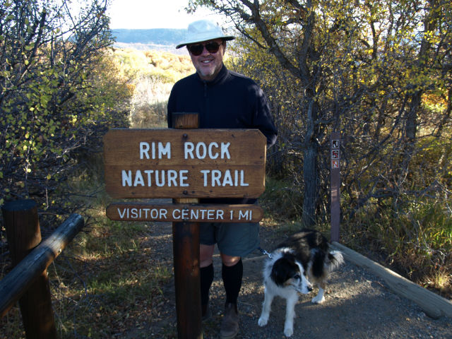
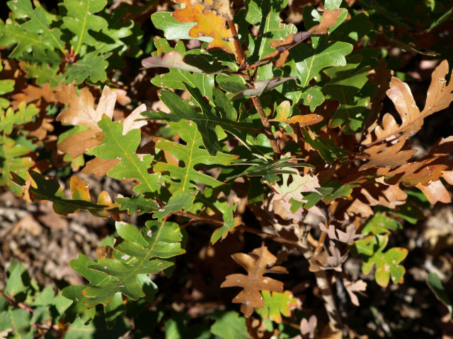
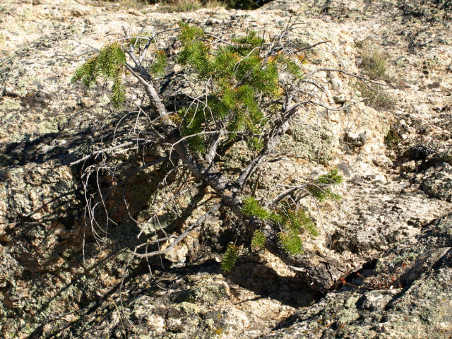
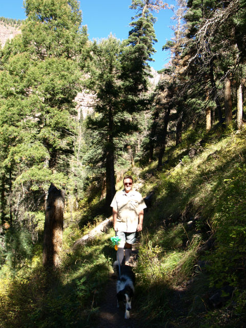
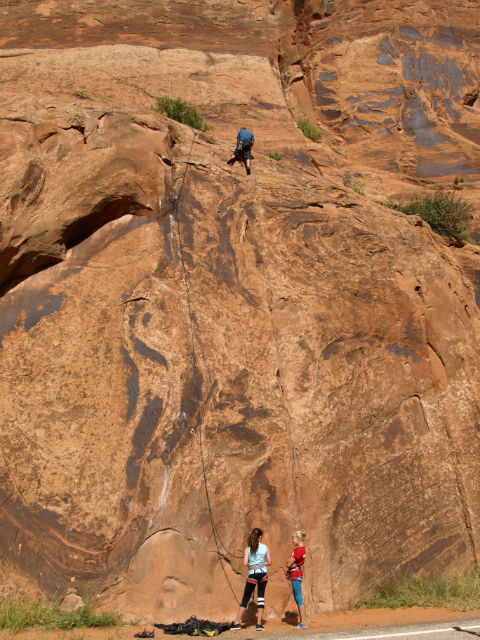
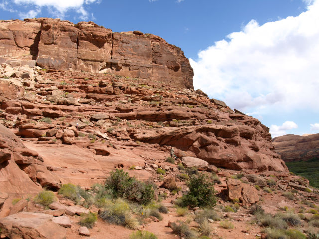
We hiked a few trails (gotta get out of the van!) along cliff edges dotted with a sparse growth pinyon-juniper woodland. Many of the scrubby junipers – scaly leaves and waxy, blue berries – are 800-years-old. In the distance we could see a group of rock climbers who’d made it to the summit of vertiginously-high Independence Rock.

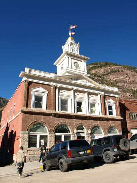
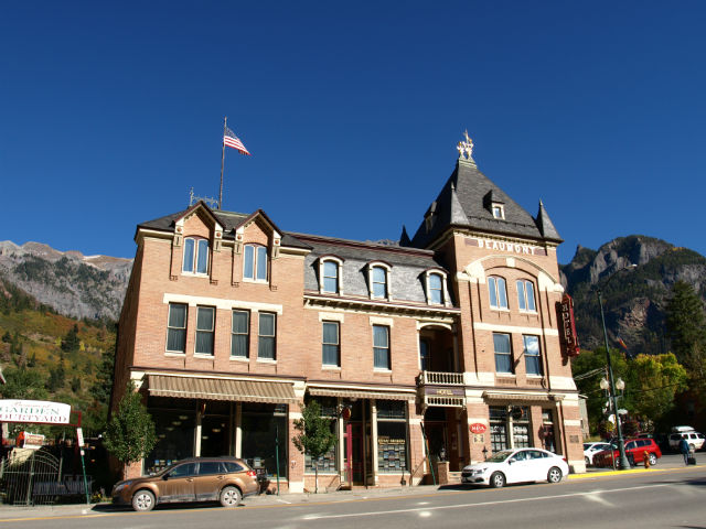
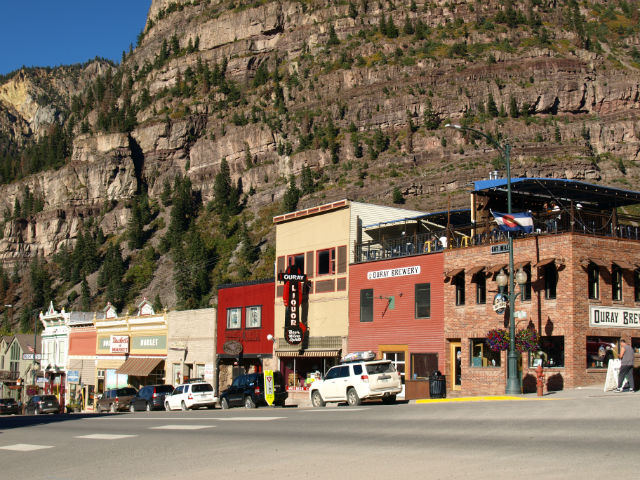
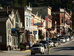
Back at valley level we overnighted and dined out in Grand Junction, a college town much the same size as our hometown. The pedestrian-friendly, downtown main street looks as though it has triumphed over the hit by the big box stores on city’s edge. There are independent, interesting eateries and shops, lots of places to sit and relax, and art sculptures that range from conventional to whimsical.

Colorado is known for craft breweries, so we ate dinner at Rockslide Restaurant and Brewery, the city’s first brew pub located in a historic, circa 1900s brick building. The menu ranged well beyond standard pub fare and there was a half-dozen of the brewery’s handcrafted beers on tap. The most popular is the Widowmaker Wheat, a mildly hopped blend of pale and wheat malts. Craig (who loves Guinness) went for the Big Bear Oatmeal Stout – declared as superb!

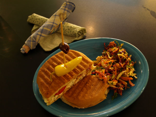
The next day we had a late afternoon lunch at Café Sol (also on Main Street) – a fantastic dining experience. Clean, funky, colourful with an interesting menu of soups, salads, paninis and desserts created with mainly organic ingredients. Incredibly fresh foods and enormous portions (they have self-serve To-Go boxes). We were splitting a side salad that could have easily satisfied four to five.

grj2

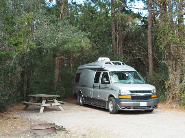
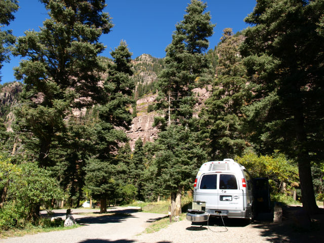
While we do have a strong preference for the more rustic state and national park campgrounds, our spot at Junction West RV Park hit several markers: it was super clean, centrally located for all the local stops we wanted to make, super clean, had a fast Wi-Fi signal so we could write and file stories, was quiet and spacious . . .  and did we mention super clean?

www.colorado.com 

www.visittheusa.ca

grj7

Photos: Close to Moab … and almost had the place to ourselves!

We found spots around Moab where there was … almost no one!

What really floors us about the area around Moab is how many visitors from out of state seem lasered on Arches National Park. We stopped a while at the Visitor Center along the I-70 interstate and listened in as one visitor after another asked only about Arches. We loved that particular park, but were just as enamoured with the other sites (some a bit more off the beaten path) that had no lineups, no crowds and, in some spots, almost no other people.

moab12

That’s how we spent this day. Exploring some of the lesser known routes and hiking trails.

We started with the road marked Scenic Byway 279, just 7km/4mi north of Moab. The narrow road is paved and snakes beside the Colorado River. It’s a one-way trip (at least for a camper van) and is miles of astounding scenery and scenic pullovers until it turns into a rougher dirt road that heads deep into the floor of the canyon. On our wish list for next time: a 4WD tour past this point.

Right from the start, we were treated to soaring red rock cliffs on our right hand side, a favourite spot for rock climbers. They seemed to be the only other ones using this roadway.

moab14

There are pullouts along 279 to look at the Indian rock art and one great hike up to three-toed dinosaur tracks preserved in a flat slab of rock. It was a short climb up to get a very close look at the fossilized tracks. Amazing to see these and we wondered how many more fossilized remains must be caught in the miles and miles and layers of these remote red rock canyons.

moab8

We try to make sure we get out from the van and do a little hiking every day. We found the perfect spot at the pullout for Jug Handle Arch (another of the Moab area’s trademark arch formations). We had the place to ourselves, walked into the canyon, an area of Bighorn Sheep and cathedral-like red rocks that seem to vault up all around.

The next day we left Moab (and Utah) heading for Colorado and took the more backroads route, Scenic Byway 128 which also tracks the Colorado River, this time upstream. Highways 279 and 128 both follow the mighty river, and we saw many pretty BLM campgrounds, right on the riverbanks. These sites would be around $15USD/night, have few facilities, but the settings can’t be beat. They are on our list for the next time we are through.

moab3

It’s a great route for biking with a dedicated paved riding trail along a long stretch, rafting (also on our list for next time – can’t believe we missed it this time around!), birding and just a scenic drive. Heading east, the landscape changed dramatically (which has made route 279 a favourite for movie shoot locations): from the tall red cliffs that are the backside of Arches National Park, to spires, buttes and pinnacles, to rubble-like moraine to wide open high plains. We drove past the abandoned community of Cisco, which was once part of a robust mining economy and later a film site for Thelma & Louise.

moab1

Sad to say goodbye to Utah. Excited about exploring Colorado.

We’ve posted all sorts of photos here.

www.visitutah.com

www.visittheusa.ca