Just 90 seconds of video … a little bit of Yellowstone’s amazing geothermal activity. This is what it’s like to be in the middle of the caldera in a super volcano! YELLOWSTONE SHOWS ITS STUFF!
A little Yellowstone video
Leave a reply
Just 90 seconds of video … a little bit of Yellowstone’s amazing geothermal activity. This is what it’s like to be in the middle of the caldera in a super volcano! YELLOWSTONE SHOWS ITS STUFF!

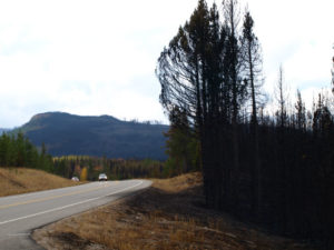


Our travel schedule and route was looking a little iffy as the south entrance of Yellowstone was closed for a few days due to the large Berry forest fire. It’s been burning (result of a lightning strike) since late July and a day of high winds had whipped up the flames. The roadway out for us was closed. Then came a day of rain and … fire still burning but road opened.
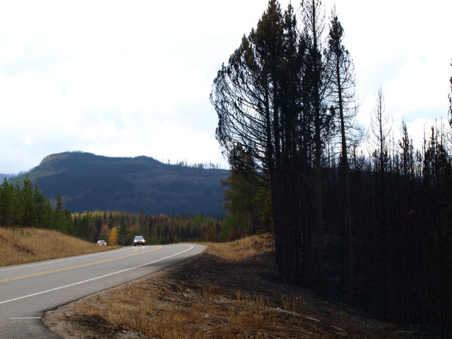
We had mixed feelings about leaving Yellowstone since it is a one-in-a-million destination but we knew we needed to head on to Grand Teton National Park, just a short drive to the south of Yellowstone. Along most of the roadway between the two parks were acres of burned forest, black trunks of the lodgepole pines, foliage all scorched away and – in many places – hot spots still smouldering. But once we reached Grand Teton/Jackson Hole, all was back to green.
Semantics first. Jackson Hole refers to the region encircled by mountains. Jackson is the small, chi-chi town just past the south end of the park. The protected land that covers most of the area is Grand Teton National Park.
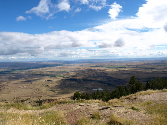
What a difference a few kilometres makes! Grand Teton is a completely different landscape. behind us were the geothermal geysers and mud pots of Yellowstone. Grand Teton is a textbook of plate tectonics and glaciation: uplift and slippage, earthquakes and thick glaciers that scoured out the valley. The whole area was like a university flashback for Jo, whose study minor was geology.
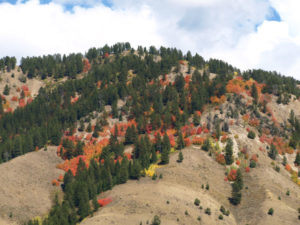
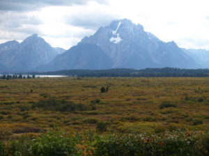
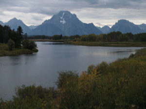
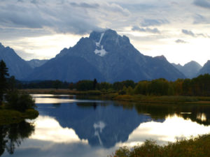
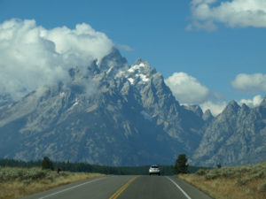
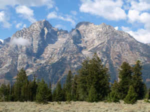
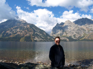
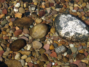
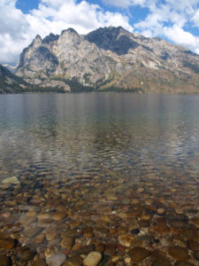
The visual buffet is the 80-km long Teton Mountain Range, formed by plate tectonics. All along the north-south drive, the rough peaks seem to rise right out of the lakes and valley below, with no foothills at all. We drove parallel to the entire range, with Jackson Lake and Jenny Lake between the roadway and the mountains. In September, the aspens are turning yellow, so there are bright splashes of colour on the mountainside. There are many bike paths and hiking trails (sorry Rigby, no dogs allowed). The wide expanse of the valley is spotted with sagebrush (the plants deep tap roots allow it to withstand weather and drought extremes).
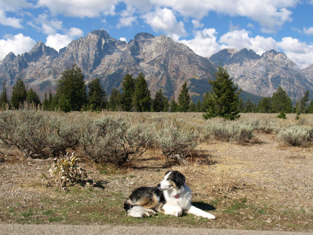
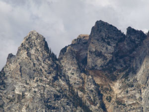
This is a youthful landscape – geologically speaking – with strong tectonic forces at play. The fault line is still active and geologists expect a major earthquake could happen at any time. The range is one of the youngest on Earth – jagged peaks that have not yet been worn down by erosion.
Here’s how the region was formed. Around 10 million years ago, the two plates along the north-south Teton Fault slipped – on the mountain side the land was pushed upward, while on the valley side, it dropped. Over many eons of movement, the displacement approached 30,000 vertical ft.
Enter erosion. Two million years ago, glaciers filled the valley, leaving behind huge amounts of glacial debris, sort of levelling the valley’s sinking floor. There are still glaciers in the alpine areas, although they have receded almost 25 percent in the past 40 years, courtesy of climate change.
This scenery is jaw dropping. We wish we’d booked more time aside to just sit and stare at it.
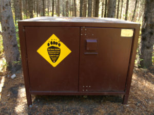
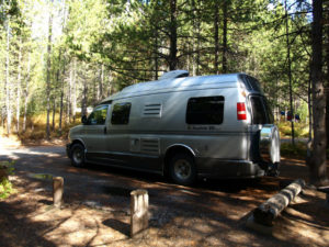
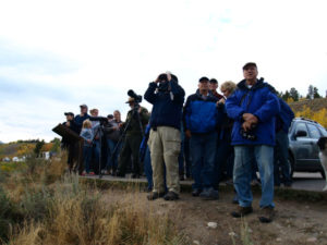
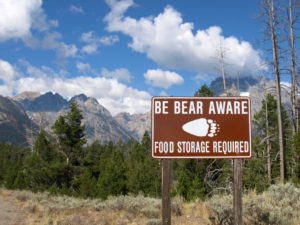
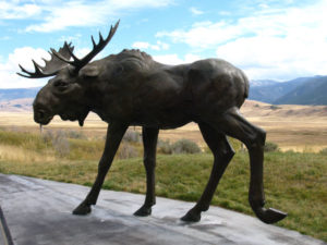
Grand Teton is also home to much wildlife – bears, wolves, bison, elk, moose and pronghorn antelope. Just outside the south end of the park – and close to the town of Jackson – is the large National Elk Refuge, a protective wintering area. We camped at the small but very nice Signal Mountain campsite — bear warnings, food storage boxes and the whole nine yards in place. In the evening we met a group at the Oxbow Bend turnout for a ranger talk about wildlife spotting.
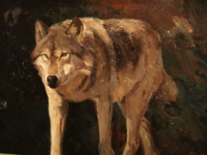
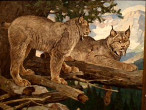
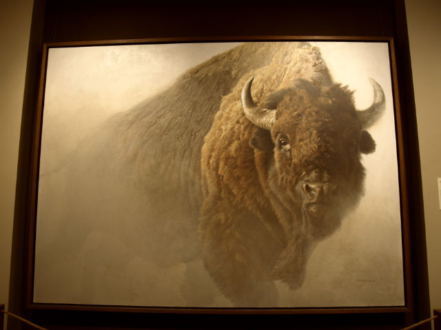
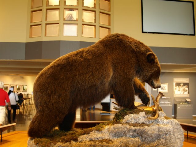
Wildlife related – but on canvas rather than moving through forests – is the fantastic National Museum of Wildlife Art just outside the Grand Teton south entrance. The museum’s mission is to explore how art helps us understand humanity’s relationship with wildlife and nature. The pictures and scultpture on display ties beautifully with the wildlife of the region. The carefully-curated galleries are divided into themes like pieces that illustrate familial roles, the heroic male (often standing on a rocky precipice, with an air of importance), the female of the species, and the predator and prey. A favourite was Chief, by Canadian artist Robert Bateman, of a massive bison in the mist. The museum is a must-see stop.
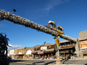
After leaving the museum, we drove through Jackson (no stops – this is a shopping-free expedition) and opted for the Scenic Byway route through Alpine and Afton, where we stopped to see the world’s largest Antler Arch! Thirty-thousand elk antlers and counting. Okay, kitschy but impressive.
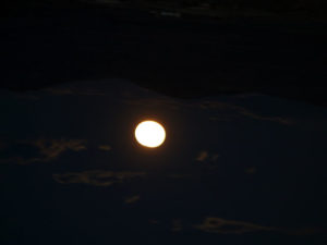
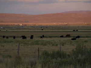
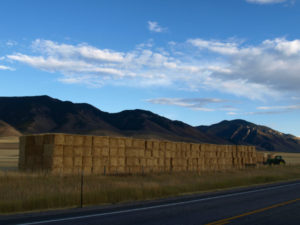
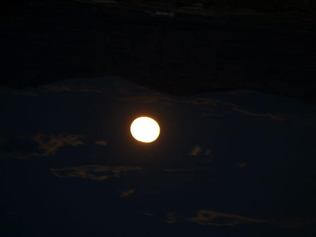
The drive south along Highway 89 (dipping back and forth into neighbouring Idaho) follows much of the Snake River, with National Forest Service campsites and boat launches all along the route. The views gobbled up camera disk memory. South of Smoot, WY the land changes from hills and valley forest to wide expanses of ranch grasslands: Black Angus cattle as far as the eye could see, and serious stacks of rolled hay bales. To the west we were treated to a spectacular Wyoming sunset that turned the sky red and pink, and just minutes later the harvest moon rose over the mountains to the east. Talk about perfect timing.
Like the last few posts, we’ve added a separate photos-only post. Have a look and tell us what you think.
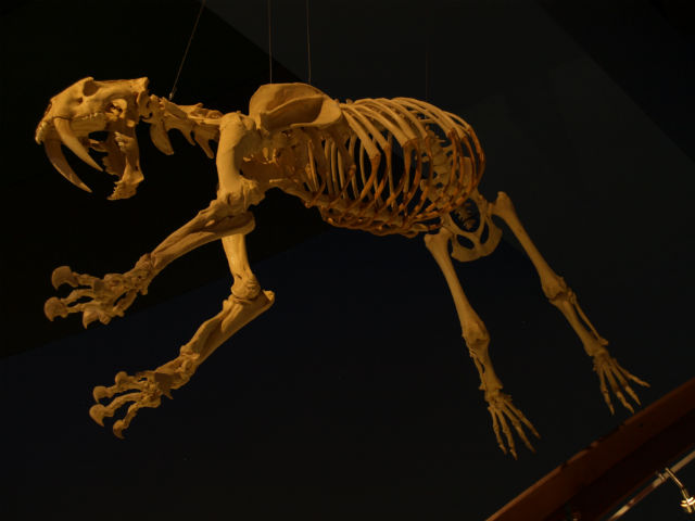
We got our first idea of the Yellowstone wildlife to expect back in Cody, WY at the amazing Buffalo Bill Center of the West. In the Draper National History section there were detailed explanations of the various landscapes that make up the Greater Yellowstone region – the more open Northern Range, the lodgepole pine forests (they cover 80% of the parkland), the plains (“where the buffalo roam”) and the mountain meadows. It was just the primer we needed before heading into the park.
Signing into the Yellowstone campgrounds involves more than just site assignment. We had to initial a waiver acknowledging that we were in grizzly country. Huge metal food lockers for tenters to use. Lots of bear information – the what-to-do-if scenarios. Dogs are not allowed on the hiking trails (sorry Rigby) although it’s pretty easy to understand.

Now that we’re here, we’ve seen lots of wildlife (although not the elusive gray wolf nor the grizzly). So many bison that after a day or two you start to get blasé about the experience. Ditto for the elk – although we did have a magical early morning viewing of elk silhouetted against the sunrise that will be forever imprinted on our brains. There have been many deer and a coyote snoozing in the field between the geysers. One, lonely bighorn sheep (“the master of the mountain”) nibbling on some grass and a flock of snow white pelicans fishing in the Yellowstone River. At the museum we learned that the bighorn sheep have air filled chambers in their skulls to absorb head-on-blows.
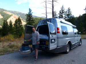
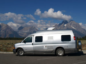
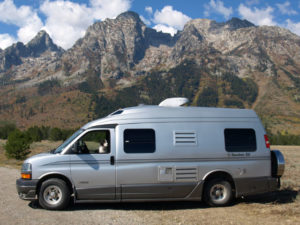
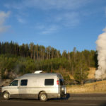
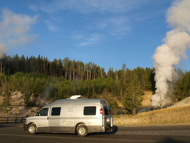
On the second day in Yellowstone, we set our alarm for 6am and were on the road 15 minutes later – freshly-brewed coffee in hand – for a day devoted to wildlife watching (gotta love the Roadtrek – it really is up-and-out in no time). Luckily, the day we chose was the one day we’ve had here with clear blue skies from start to finish.
We were barely out of the campground when we came across the harem of elk, with the sun just barely coming up behind the Absaroka Mountain Range to the east. We stopped and just watched for a good 10 minutes. What a way to start the morning!
Our goal for the day were the wildlife rich Hayden and Lamar Valleys – more open grasslands favoured by the larger animals, like the bison. And we wanted to get there early, before the car traffic started to clog the roadways.
It wasn’t long before we were slowed to a crawl by our first bison jam. These iconic symbols of the West can weight 2,000 lbs and charge at 30 mph (you and me can run – maybe – 10 mph, so you do the math). If they decide to cross the road, there’s no argument.

In the early 1800s there were an estimated 60 million bison roaming the Great Plains of the West. They were hunted so intensely that they were almost wiped out – by 1890 there were fewer than a thousand left. The Yellowstone herd was protected in the early 1900s and has now grown to a herd of about 4,000.
The Lamar Valley and the Northern Range are much more open, fewer trees, more grasslands and high plateaus peppered with sagebrush. This open topography is favoured by the bison and by the grizzlies. Saw the former (in spades), still looking for the latter. Black bears prefer the mix of woods and meadows.
When you come to Yellowstone and are looking for wildlife, here’s where you want to go:
We’ve posted a separate photos-only piece about Yellowstone wildlife. Have a look. Have you been to Yellowstone? If so, what wildlife did you come across?
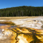
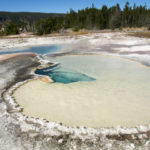
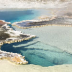
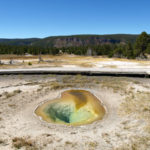
Yellowstone National Park is a place that touches all the senses: sight, smell and the sound of those geysers blasting and burping into the air. How about some photos to tell the story (click on any one to enlarge) . . .

Think of Yellowstone as an “Acts of God Theme Park.” It’s the most apt description we could conjure. There is so much to see and do in this mammoth national park that we’ve decided to write several posts – one on the geothermal activity in the park and another on the incredible wildlife. In addition, we’re going to create a few “photos-only posts.”
A bit of background: Yellowstone is the first U.S. National Park, established in 1872 by President Ulysses S. Grant. Pull out your map – you’ll find it in the northwest corner of Wyoming (although margins of the park cross over into Montana and Idaho).
Of course, as soon as we arrived at our campground, the temperature plummeted and it snowed. We felt so sorry for the campers in tents but we stayed dry and warm. We stayed at both Grant and Madison campgrounds operated by Xanterra – if you visit, make reservations early as the campgrounds fill up (even in snowy and cold weather!). The sites were well wooded and – this was a first for us – on registration we had to sign an acknowledgement about bear activity, both black and grizzly. There are large metal food storage boxes for tenters to use and all sorts of signs about bear activity.
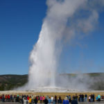
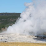
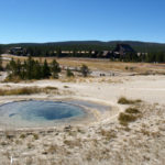
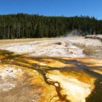
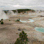
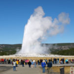
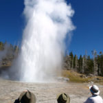
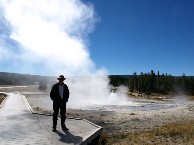
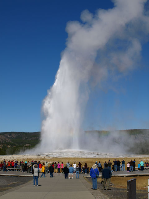
So, let’s start with the geothermal sights. Everyone knows about Old Faithful – it’s one of 10,000 geothermal volcanic vents in the park – it was great but not the most interesting by far. A park staff member told us it gets the most press because “you don’t have to walk far from the parking lot to get to it.”
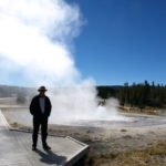
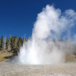
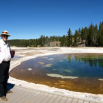
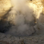
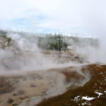
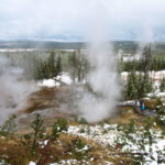
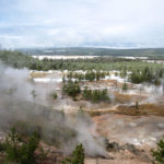
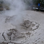
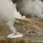
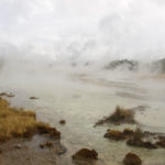
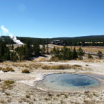
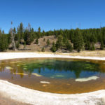
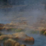
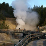
We couldn’t get enough of the other sites – we laced up our hikers and walked the boardwalks, paths and overlooks to see steaming hot springs, mud pots belching blobs of liquid clay, geysers that erupted columns of superheated water, green, yellow and blue hot pools. And everywhere, streams of steam rising into the air.
The park is actually the location of a huge collapsed volcano caldera, the remains of the last major eruption 640,000 years ago. The huge crater marks the volcanic heart of the park. Oh yeah . . . It’s due to blow anytime and the eruption would wipe out most of the Northern hemisphere – isn’t that a cheery thought?
A few facts to wrap your mind around:
Here’s our list of the best of the best – geothermal features that really captured our attention:
www.YellowstoneNationalParkLodges.com provides info and online reservations for lodging and campgrounds in Yellowstone
There were a couple of typical small Western towns we wanted to explore on the way to Yellowstone National Park – Sheridan and Cody, both in Wyoming.
We stayed a couple of nights in the super tidy Peter D’s RV Park: walking distance from downtown Sheridan, very clean showers and laundry, Wi-Fi included (although the signal was slow when the park filled up in the evening) and very, very dog friendly. Pete met us with a couple of dog treats for Rigby and then showed us the four-acre, fenced off-leash dog yard. This was great – after being cooped up in the van with us, Rigby really needed to stretch her paws.
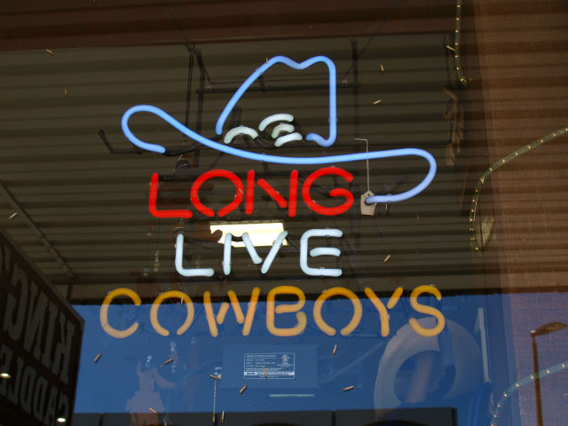
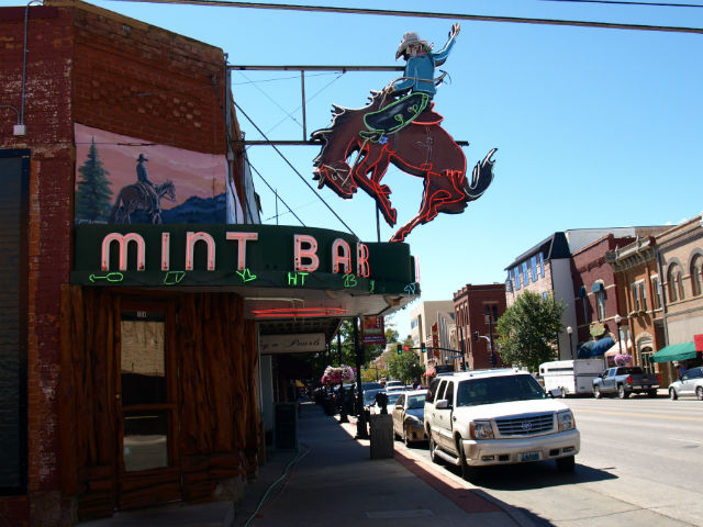
What we liked most about downtown Sheridan is the authentic Western town feel. No fancy airs, a beautifully restored, historic downtown main street, small independent shops and all set against a backdrop of the stunning Bighorn Mountains.
This region is the setting of the Longmire book and TV series (Netflix) – author Craig Johnson is a local fellow who writes in details about the landscape and the people here.
Sheridan has long been a railway town – the tracks run a few blocks above main street – it was a nice stop to take a break and get settled into the Western mindset. Here were the highlights of our stay:
Once we tore ourselves away from Sheridan, we went west along Highway 14 into the Bighorn National Forest and up and over the Bighorn Range on the Wyoming Scenic Byway. There was a dusting of snow on the trees at the 8,300-ft pass and we slowed down for a herd of cattle and wranglers making their way along the roadway. Outside temperature up top was just above zero Celsius. Back in Ontario they were sweating through an unusual September heatwave!
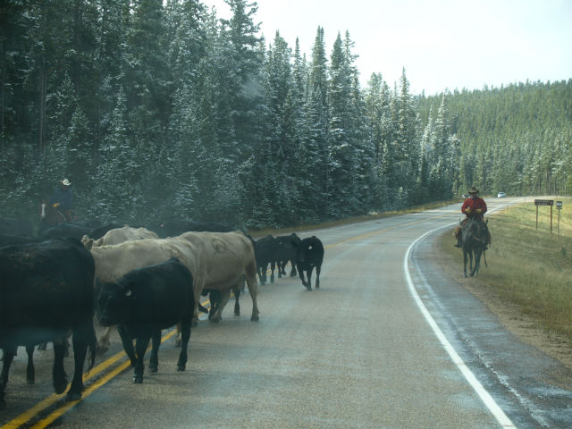
What an amazing drive! One scenic vista after another and barely passed another vehicle the whole way (cattle yes, cars not so much). After the mountains and at the edge of the Bighorn Basin we passed through Shell: population 83 and home of two establishments, a campground and the Shell Beer-Café (guess they have to cover all the bases).
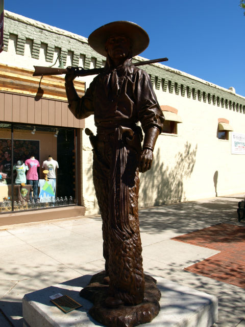
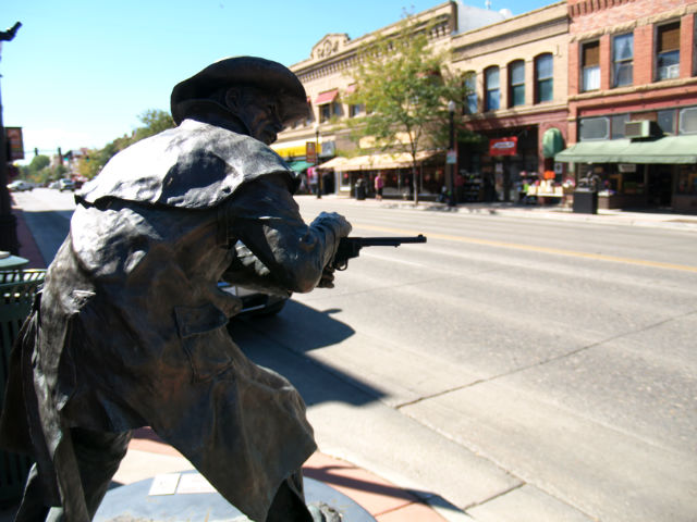
We arrived in Cody and were immediately taken with the main street – again, great, authentic architecture. Cody has a beautiful location, a rodeo grounds and lots to explore in town. We only had time to spend a few hours at the world-class Buffalo Bill Center of the West (a Smithsonian affiliate museum). It is huge – divided into five smaller museum galleries from natural history to the Plains Indians to firearms.
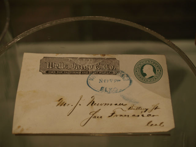
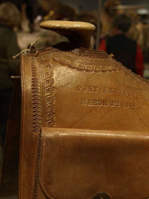
The museum aims to immerse visitors into the story of the real American West. William F. “Buffalo Bill” Cody believed that by encountering authentic western things, people would come to understand and appreciate the West. He started as a scout for the U.S. Army but is best known for his Buffalo Bill Wild West Shows. Lots of archives on display like a cancelled Wells Fargo envelope, Pony Express saddles, telegraph equipment, etc.
The part we liked the best was the natural history (the Draper Natural History Museum) on the sights, smells and sounds of the Greater Yellowstone region. It was very hands-on and touched all the senses. Howling wolves, bubbling hot springs, raging forest fires. Could have spent a whole day just in this section.
It was a 90-minute drive to the east gates of Yellowstone National Park and another hour from there to our first night’s campground. So, more of Cody will have to be on the “next time” list. The drive east out of town is stunning – the beautiful drive up and over the Absaroca Range (a part of the Central Rocky Mountain Chain). We passed beautiful riverside campgrounds that are on our list for another time. We could happily be based in Cody for a few days to explore the town and the hiking/driving opportunities in the nearby mountains.
On to Yellowstone . . .
After leaving the northern part of Custer State Park (still quivering after the Needles Highway drive!) we continued west and stopped for the night at a fantastic, secluded National Forest Service campground called Rueter, just north of Sundance, Wyoming (yes, the Sundance Kid was named after this spot). There was just one other set of tenters at the campground – a young honeymooning couple. We set up our new barbecue and grilled steaks for breakfast the next morning. Life is turning out to be pretty “rough” on the road!

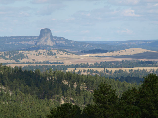
Our goal was Devils Tower National Monument, just north of Sundance. Devils Tower was the first National Monument in the NPS – established in 1906. It is still part of the Black Hills ecosystem. It’s also a popular spot for rock climbers. You may recognize it as Steven Spielberg’s location choice for Close Encounters of the Third Kind.
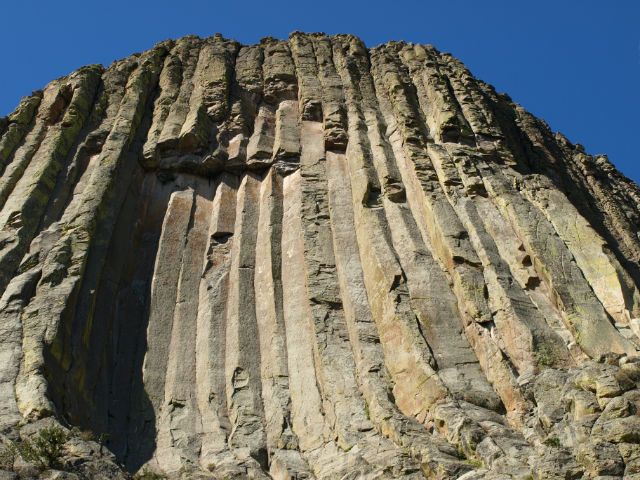
Devils Tower is a sacred butte to many of the Northern Plains Indian tribes (who oppose climbing the rock). Many Native stories involve bears – and at this site, the vertical lines look like a bear had clawed at the rock.
We approached via Highway 14 from the south, came up over a ridge and there it was in the distance. Even though it was still quite far away, it was much more sudden and breathtaking than either of us expected.
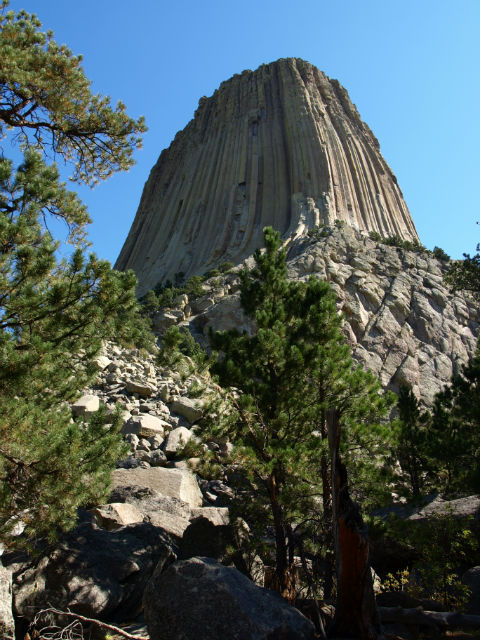
Up close, it is even more impressive: 1,558 metres high with sheer sides. Jo hiked the 2-km Tower Trail circling the base. The first half of the trail was busy but the last part was almost deserted – the lovely sound of the wind whistling through the ponderosa pines, chipmunks scurrying everywhere, birds chirping. Along the way, bright prayer flags or bundles were tied to tree branches.
Here’s your geology primer for the site: The tower is composed of igneous rock formed 1.5 miles below the surface, when the magma pushed up through the sedimentary rock layers about 50 million years ago. The rest is erosion, which stripped away the softer layer of sedimentary rock, leaving the cylinder-shaped igneous intrusion.
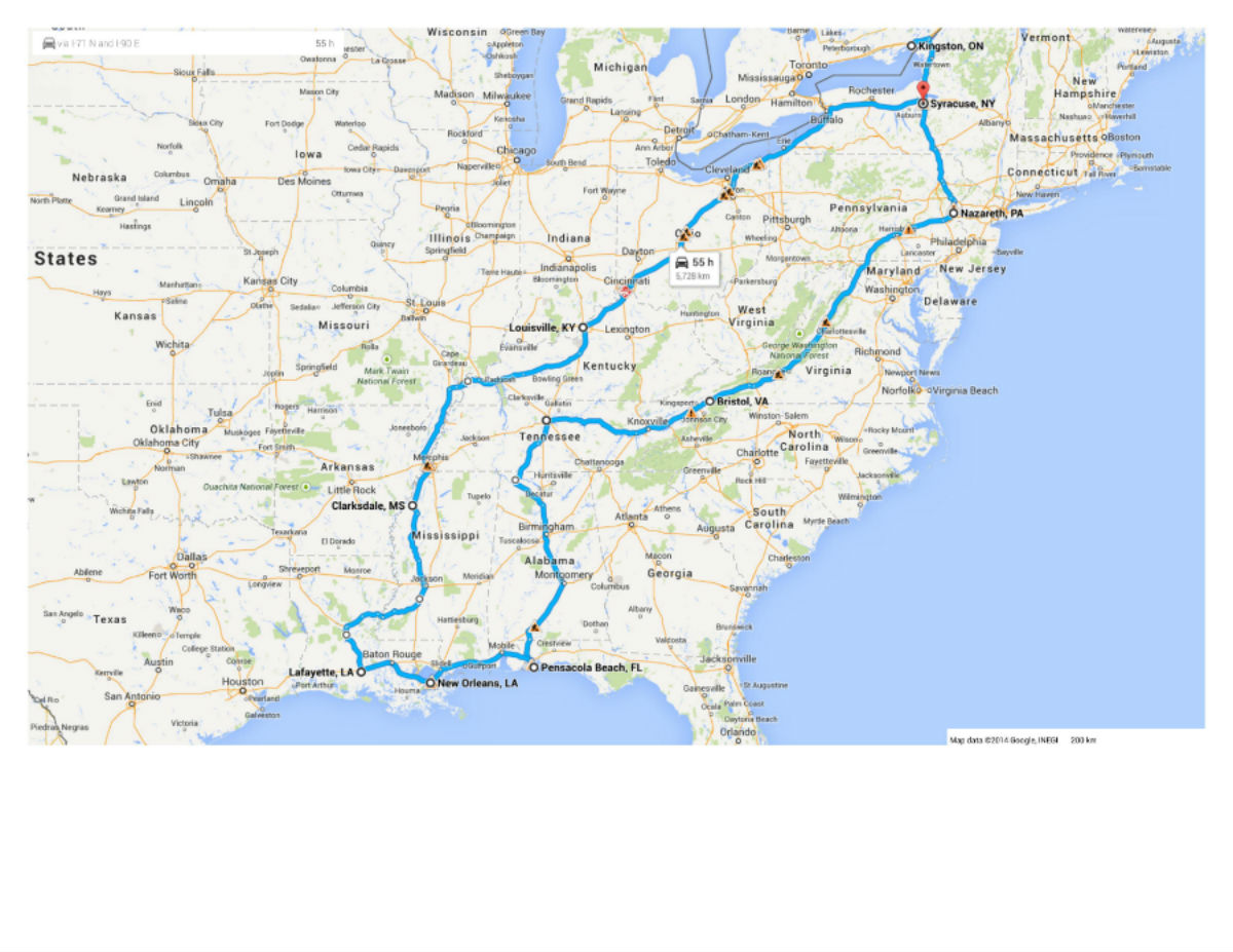
Fun fact: Parts of Close Encounters of the Third Kind were filmed at the grassy knoll close to the boulder field at the base of the tower. But, most of it was shot inside a Goodyear hangar in Mobile, Alabama.
Did you know: A National Park is established by an Act of Congress; A National Monument is established by Presidential order?
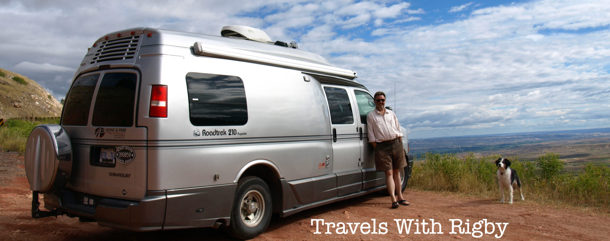
Spring and fall, we load the van – with everything from guitars to laptops – toss in a thick bundle of maps, several notebooks and roll down the road. We meet great people, gather wonderful story material and then write, write, write. Browse the links to some of our pieces in print:
Exploring The Small-Town Charms of New Brunswick’s Bay of Fundy, Zoomer