Category Archives: U.S. National Parks

Rocks are so much more interesting than Brangelina!

This part of Utah – here at Utah’s Canyonlands – is what writer and environmentalist Edward Abbey called the “most arid, most hostile, most lonesome, most grim, bleak, barren, desolate and savage quarter of the state of Utah – the best part by far.”

cl10

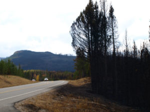
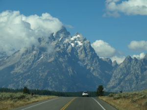
It was another early alarm clock day as we set off for both Canyonlands National Park and neighbouring Dead Horse State Park, about a 35-minute drive from our campground in Moab. We wanted to beat any crowds and be there as close to sunrise as possible.

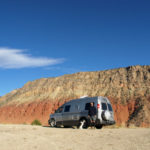
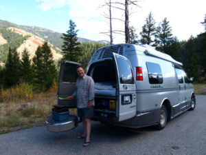
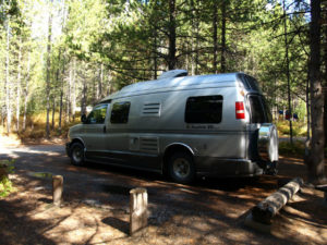
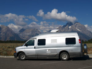
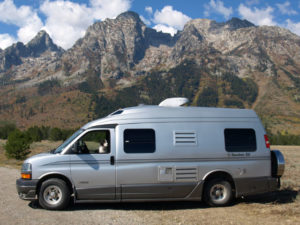
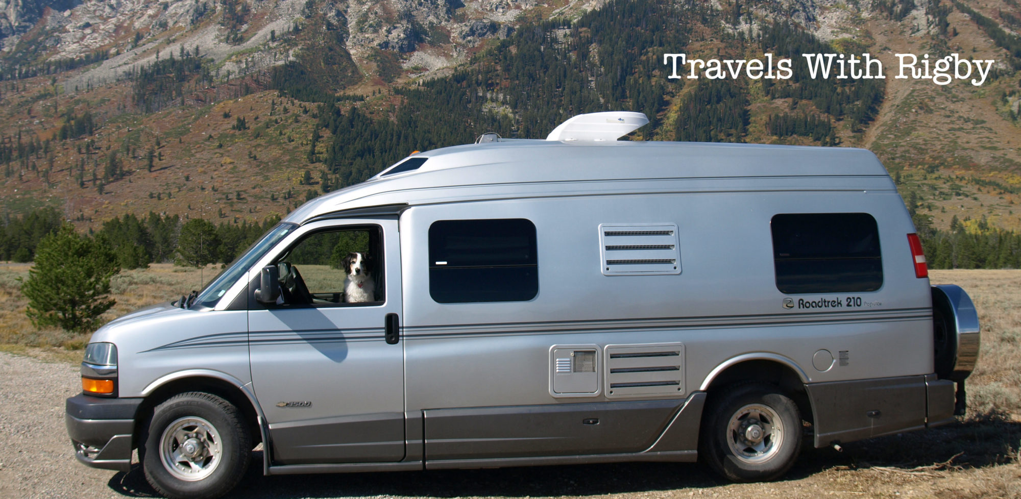
We pulled into the park before the Visitor Center was even open, so set up and cooked breakfast. We love this about the Roadtrek – we can cook, eat, clean up (and take short naps) ANYWHERE. The flexibility of the lifestyle is irresistible.

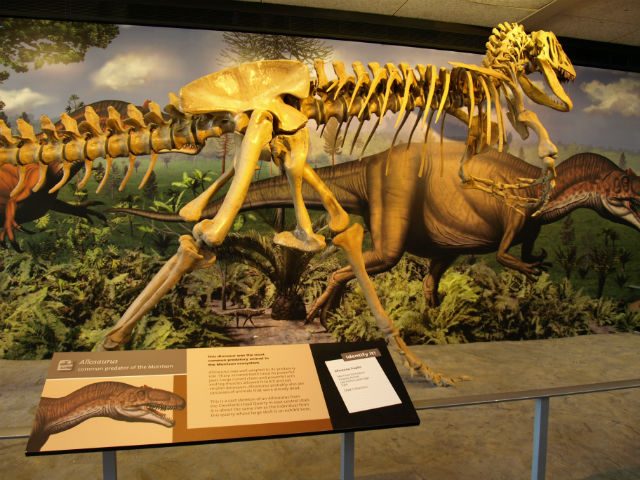
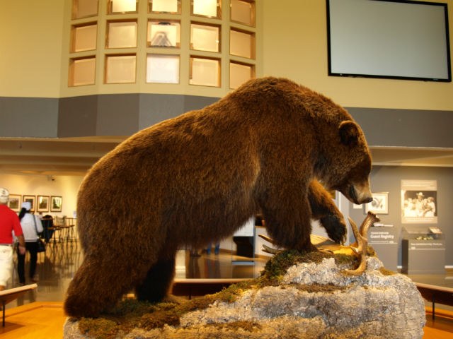
After brekkie, we watched the excellent short film at the Canyonlands Visitor Center, just to get an idea of what was ahead. We’ve been finding that the park intro films give us just the right amount of background about geology, wildlife, etc. to really help us appreciate our visit.

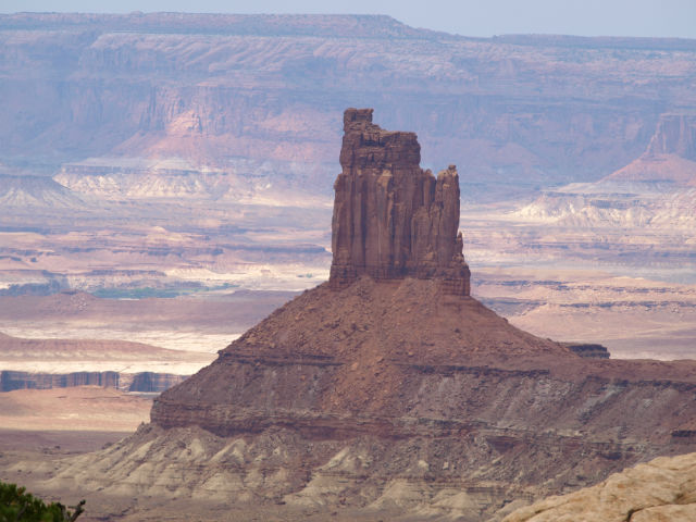
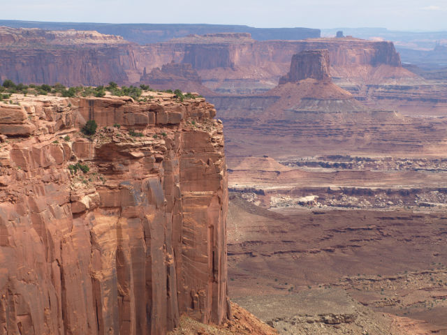
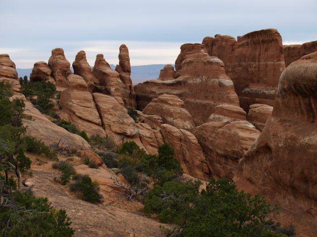
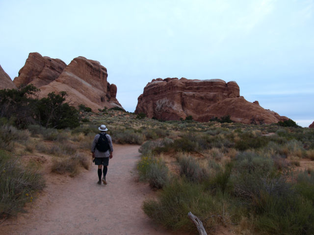
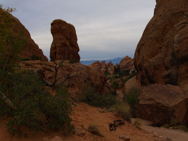
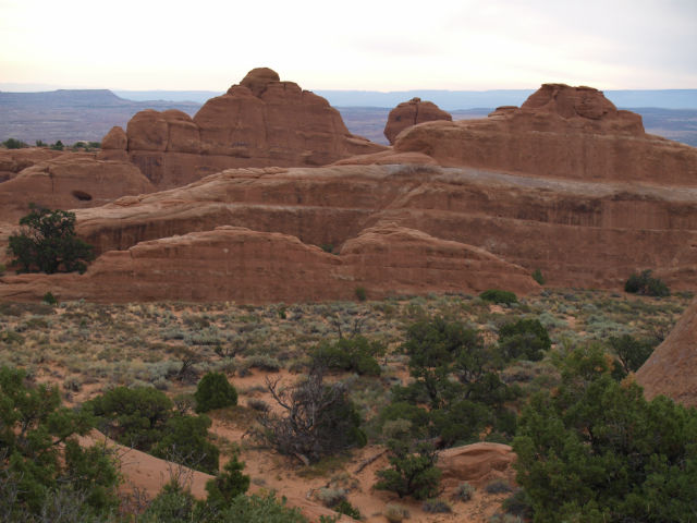
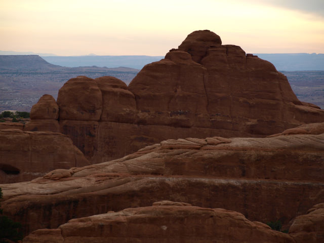
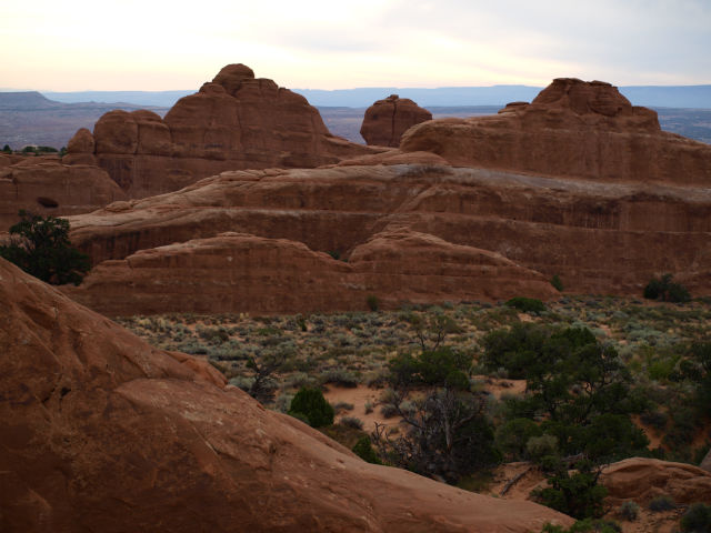
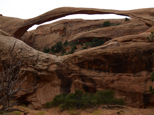
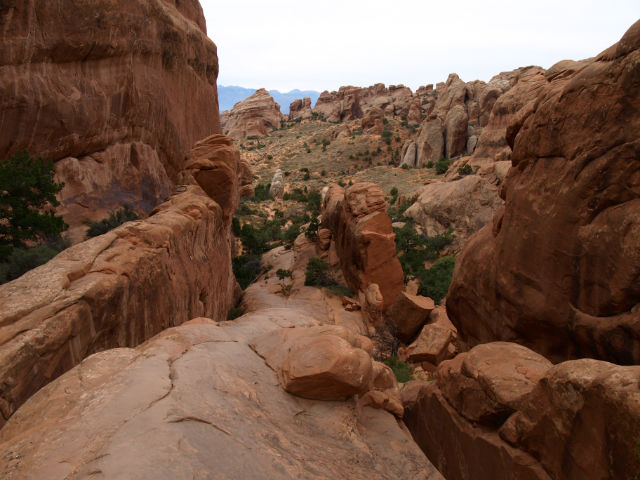
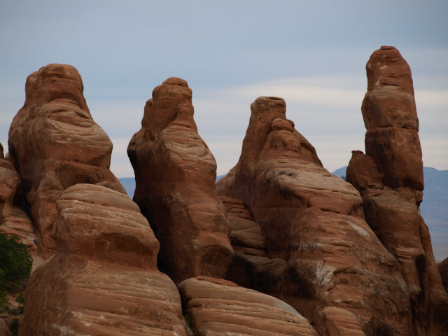
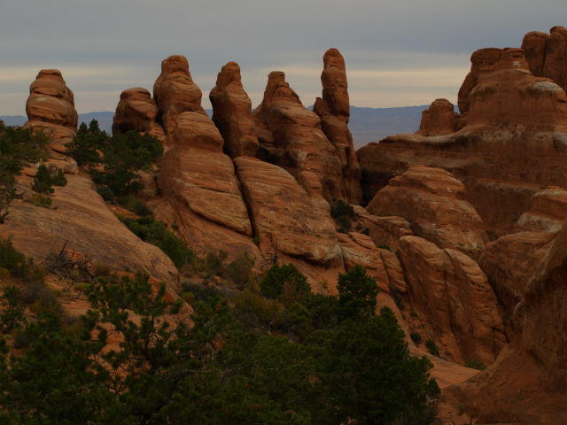
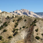
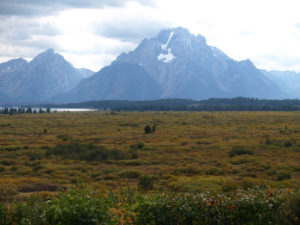
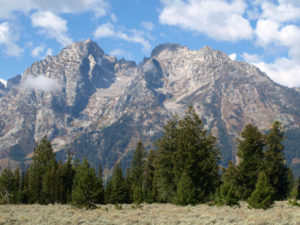
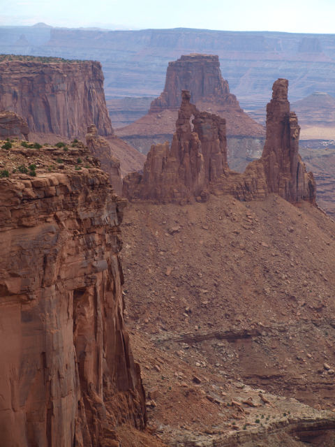
While the roads and trails at Arches National Park wove between dramatic red rock formations, Canyonlands is more about never-ending vistas and the expansive canyons in this part of the Colorado Plateau. Millions of years ago, this was an area of shallow seas, sedimentation, and uplift forming the current landscape when great blocks of rock fractured and were eroded into needles, spires and arches.

cl15

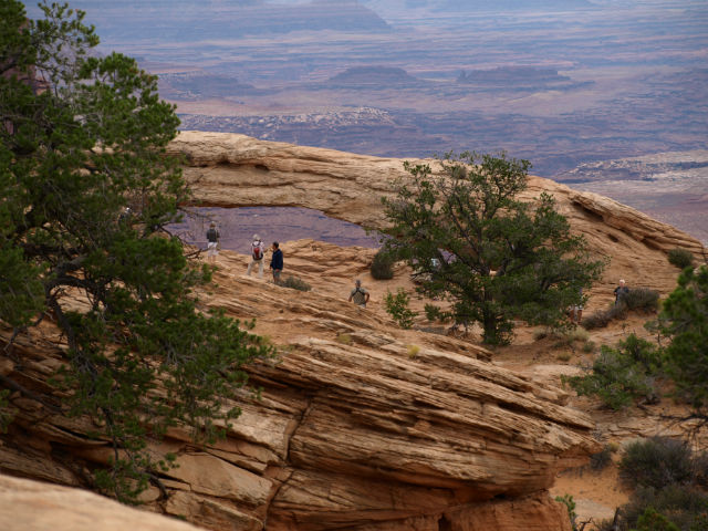
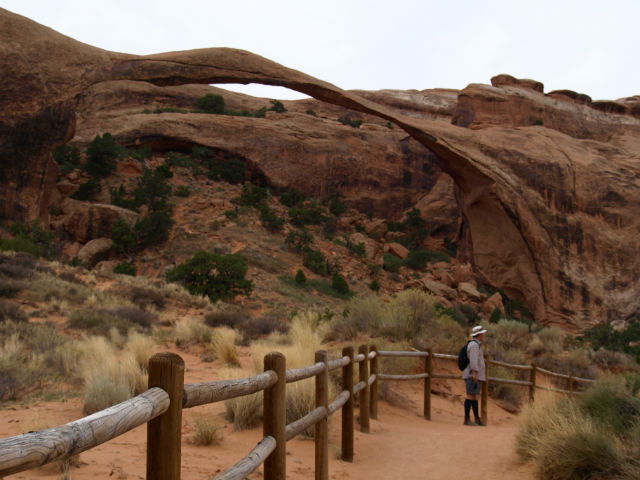
We were at one of the highlights – Mesa Arch – well before the crowds got there. That being said, Canyonlands has many fewer visitors than Arches, so there was nothing like a lineup of cars at the entry gates. In the final tally, it’s the remoteness of today’s two parks that would make them our top picks in the area.

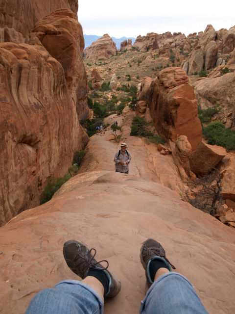
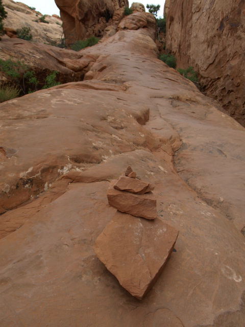
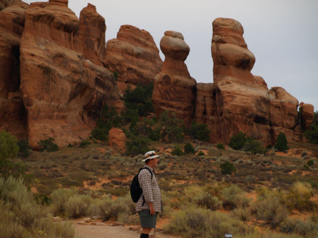
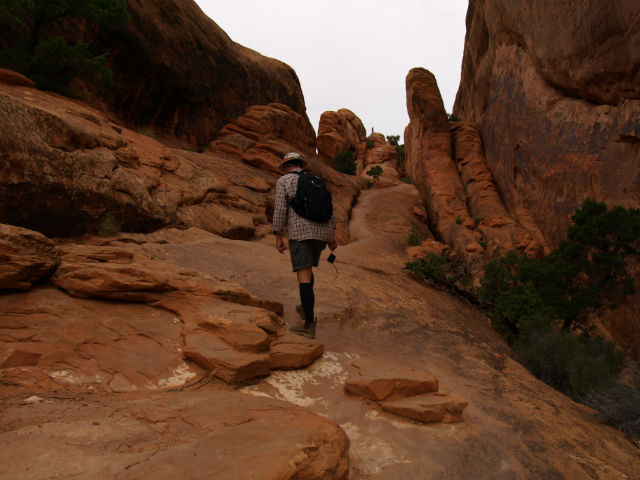
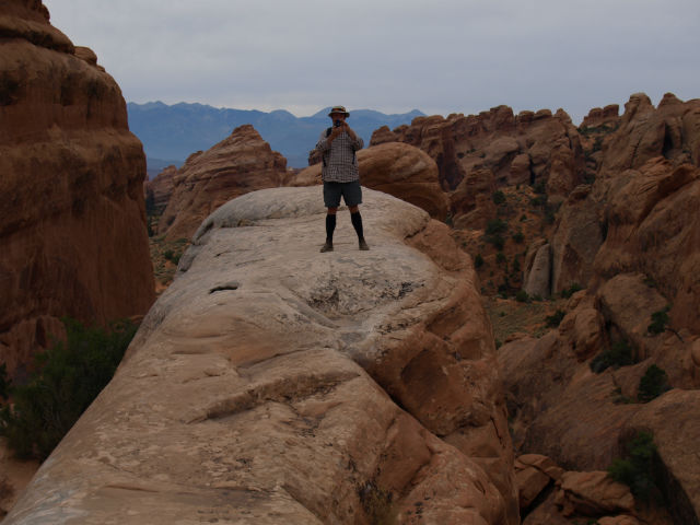
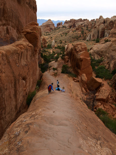
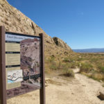
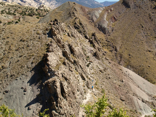
We drove all the scenic drives, got out and took hundreds of photos, did a few hikes (the short Mesa Arch loop trail and the trail at Upheaval Dome as well as rim trails at most of the lookouts). The national parks are not particularly dog friendly – dogs are only allowed in parking lots and certain paved areas, so our hiking time was pretty limited.

cl1

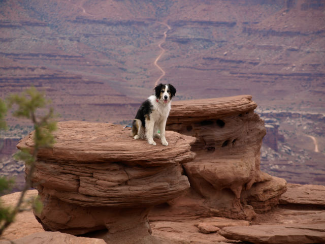
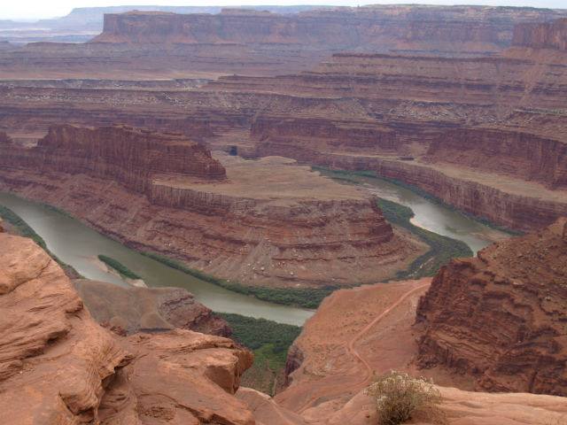
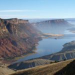
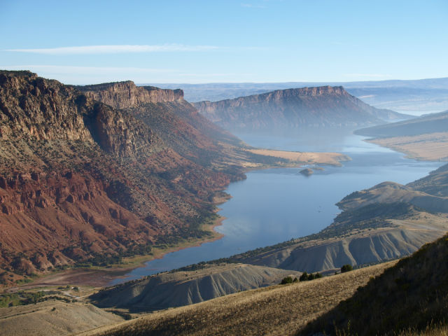
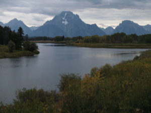
From the pullouts and trails we could see the great, wide river canyons and the meandering, wide green water of the Colorado River. Canyonlands is the confluence of the Green River and the Colorado River. The area was largely unmapped until the expeditions of John Wesley Powell in the 1860s – the same explorer who mapped Grand Canyon.

We found ourselves comparing Canyonlands to Grand Canyon. In some ways, Canyonlands seems more “relatable”: They are similar in geology, but the canyons here are much wider and more expansive (not as deep though). Next time we come here we’ll put aside a full fay to take one of the jeep tours along the very bottom of the canyons – we could see a few at a distance, navigating the dirt roads. Seeing the canyons from the “bottom up” would be very cool.

Not far down the road from Canyonlands, we stopped at Dead Horse State Park. The view from the overlook at Dead Horse Point – of the gooseneck turn in the Colorado River – is on almost every Utah Tourism brochure. It’s also close to the spot where Thelma and Louise took that famous last ride over the cliff edge.

dh4

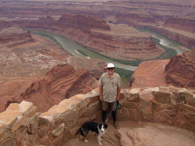
Dead Horse is like a long peninsula rising above the canyon far below. It’s said that in the late 1800s, cowboys would herd wild mustangs to Dead Horse Point, then lay brush and branches across the narrowest point called the Neck, essentially creating a natural corral.

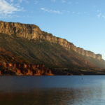
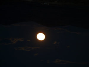
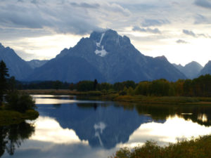
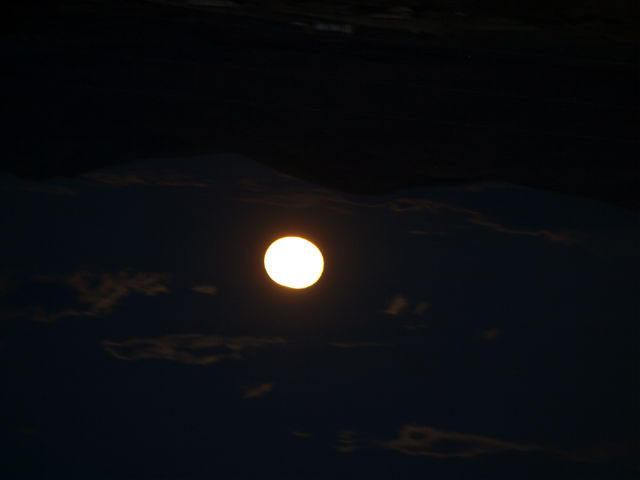
The sun was setting and we decided we wanted to spend the night in this beautiful, remote spot. The park campgrounds were full, but we tried a dirt side road and found a very nice, small BLM site called Horsethief just north of the state park. Our hope was that the skies would clear and we’d be able to appreciate the pitch black and why Dead Horse and Canyonlands have both been designated as International Dark Sky Parks. Not so lucky . . . soon after we pulled in a light rain started to fall. No stars, but the high desert after a light rain smells so very special. Clean, renewed with hints of pinyon-pine and juniper.

Edward Abbey’s book, Desert Solitaire, is an environmentalist’s classic – a great read. It’s on our bookshelf at home but, oddly enough, the public library in Kingston doesn’t have it in its collection. Ditto for his other well-known book, The Monkey Wrench Gang. They both deserve much more ink and spotlight than the current Brangelina meltdown! 

www.nps.gov/cany

www.visitutah.com

www.visittheusa.ca

cl2

Wacky questions Park Rangers hear . . .

We couldn’t make these up.

At each park we’ve chatted with the wonderful park rangers, asking them what kinds of strange questions they hear. They’ve been very diplomatic with their answers to us, but also had some real gems to share. Honestly, for some of them it’s hard to know what to say! Kind of reminds us of a bumper sticker we once saw: Go outside. the graphics are amazing!

Almost every single western park: When do the mule deer turn into elk?

yw11

Dead Horse State Park, Utah: Can you see the Pacific Ocean from here?q1
Canyonlands National Park, Utah (at the canyon rim): Is that a green screen behind you?

q2

Badlands National Park, South Dakota: Who paints the rocks?

q5

Arches National Park, Utah: How long did all this take to build?

q3

Dinosaur National Monument: Why aren’t you a Young Earth creationist?

q4

The rocks are gonna fall … someday.

The geology at Arches National Park in Utah is dizzying. (Even for someone with a geology background.)

But here’s what you really need to know: this is one popular park and it can become crowded. Tour buses. Gargantuan RVs. The whole nine yards. (We saw an RV with a bumper sticker that said: Does my RV make me look fat?). By 8:30am the cars and RVs are lined up at the entry. So, we set our alarm for 6am, were inside the park a half-hour later and on the Devils Garden Trailhead by 7am, just in time for sunrise.

a20

We (almost) had the trail to ourselves – and after a fantastic 2.5-hour hike, on the way back we met throngs of people just starting. Climbing up was not so bad. Getting down was a seat-of-the-pants affair. So glad we got there early, hiked before it became too warm and could enjoy the quiet of the red sandstone formations.

a1


Seriously though, the geology here gets complicated. (The Visitor Center has a very good movie that explains it all in a whirl.) A massive inland sea that filled and evaporated, filled and evaporated. All the while salt deposits are building up. Sediments were deposited on top of the rock, the layers buckled and the rock layers were thrust upwards creating domes which weathered over time to create the arches, pinnacles, red rock canyons and balanced rocks. This process took, oh … 300 million years.

a3

An Arches cheat sheet:

  • There are more than 2,000 arches in the park.
  • Arches are a rarity in nature’s architecture.
  • The arches were shaped by water.
  • Given enough time, all arches eventually collapse.
  • The rocks at Arches National Park are sedimentary.
  • Get through the entry booth a half-hour before sunrise. Seriously.

www.nps.gov/arch  

www.visitutah.com

www.visittheusa.ca

a25

Got dinos? Photos from Dinosaur National Park

Craig gets to play with dinosaurs

First, we overnighted near Flaming Gorge, UT and were the only ones at a National Forest desert campsite. This is what we woke up to in the morning . . .

dnm19

Crossing from Wyoming into Utah we seemed to bump up against two themes: Mormons (on the radio and on display at the large and frequent temples) and dinosaurs. Yes, this is dino country and that was a blast back to Craig’s little boy years when he was (by his own admission): Dinosaur Crazy.

Dinosaur National Monument wasn’t on our original itinerary but we have this thing about tossing the map out the window and changing course. A little out of the way, but well worth the detour.

Dinosaur National Monument straddles the border of Utah and Colorado – we were visiting the park from the Utah side. It’s in a remote corner of the state; high desert with rugged rock formations, wild river canyons and mile-long vistas. It’s the only NPS park established to protect exact dinosaur remains.

dnm18

The most famous geologic formation is the Morrison Formation, a virtual bounty of dinosaur fossils. Much of it is captured at the dramatic Quarry Exhibit Hall, an enclosed rock wall of an original dig that is one of the best places in the world to see and touch actual dinosaur bones in place. What a great idea – they found a huge cache of fossils and bones and built the exhibit around it.

dnm11

Craig drove Rigby and the van up the hillside to the exhibit building and Jo hiked the 1.2-km Fossil Discovery Trail (note to self: next time remember the hat and water).

dnm22

Why so many fossils in one place? The park ranger explained that this area was once part of an ancient river that flowed across a vast plain. A long drought killed off many of the dinosaurs and creatures, followed by extensive rains that washed their bones along the river bottom, creating what he called a dinosaur bone “logjam.” Many of the bones were concentrated at the oxbow bend in the river. Over time, sedimentary mud and rock covered the bones, fossilizing them in place.

In addition to the fossil-rich rocks and world-class dinosaur exhibits, the national monument is a geologist’s dream destination. Twenty-three layers of folded, tilted, faulted and eroded rock layers preserve ecosystems spanning 1.2 billion years. We drove the Cub Creek and Split Mountain Drives, stopping often to focus the camera and get some shots.

We’ve also created a separate photos-only post from Dinosaur National Monument. Before you go there, consider these facts:

  • 65 million years ago: all dinosaurs go extinct.
  • The Royal Ontario Museum in Toronto, Canada (ROM) has a Barosaurus skeleton excavated from an early dig at Dinosaur National Monument.
  • The quarry site represents fossils collected from 400 different dinosaurs.
  • The park is one of the best windows into the era of Upper Jurassic era dinosaurs.
  • Craig was one happy camper. He got to play with dinosaurs all day!

www.nps.gov/dino/index.htm  

www.visitutah.com

www.visittheusa.ca

dnm17

Follow us with photos: Grand Teton & our way through SW Wyoming

Grand Teton and a harvest moon rising

Our travel schedule and route was looking a little iffy as the south entrance of Yellowstone was closed for a few days due to the large Berry forest fire. It’s been burning (result of a lightning strike) since late July and a day of high winds had whipped up the flames. The roadway out for us was closed. Then came a day of rain and … fire still burning but road opened.

gt21

We had mixed feelings about leaving Yellowstone since it is a one-in-a-million destination but we knew we needed to head on to Grand Teton National Park, just a short drive to the south of Yellowstone. Along most of the roadway between the two parks were acres of burned forest, black trunks of the lodgepole pines, foliage all scorched away and – in many places – hot spots still smouldering. But once we reached Grand Teton/Jackson Hole, all was back to green.

Semantics first. Jackson Hole refers to the region encircled by mountains. Jackson is the small, chi-chi town just past the south end of the park. The protected land that covers most of the area is Grand Teton National Park.

What a difference a few kilometres makes! Grand Teton is a completely different landscape. behind us were the geothermal geysers and mud pots of Yellowstone. Grand Teton is a textbook of plate tectonics and glaciation: uplift and slippage, earthquakes and thick glaciers that scoured out the valley. The whole area was like a university flashback for Jo, whose study minor was geology.

The visual buffet is the 80-km long Teton Mountain Range, formed by plate tectonics. All along the north-south drive, the rough peaks seem to rise right out of the lakes and valley below, with no foothills at all. We drove parallel to the entire range, with Jackson Lake and Jenny Lake between the roadway and the mountains. In September, the aspens are turning yellow, so there are bright splashes of colour on the mountainside. There are many bike paths and hiking trails (sorry Rigby, no dogs allowed). The wide expanse of the valley is spotted with sagebrush (the plants deep tap roots allow it to withstand weather and drought extremes).

gt9

This is a youthful landscape – geologically speaking – with strong tectonic forces at play. The fault line is still active and geologists expect a major earthquake could happen at any time. The range is one of the youngest on Earth – jagged peaks that have not yet been worn down by erosion.

Here’s how the region was formed. Around 10 million years ago, the two plates along the north-south Teton Fault slipped – on the mountain side the land was pushed upward, while on the valley side, it dropped. Over many eons of movement, the displacement approached 30,000 vertical ft.

Enter erosion. Two million years ago, glaciers filled the valley, leaving behind huge amounts of glacial debris, sort of levelling the valley’s sinking floor. There are still glaciers in the alpine areas, although they have receded almost 25 percent in the past 40 years, courtesy of climate change.

This scenery is jaw dropping. We wish we’d booked more time aside to just sit and stare at it.

Grand Teton is also home to much wildlife – bears, wolves, bison, elk, moose and pronghorn antelope. Just outside the south end of the park – and close to the town of Jackson – is the large National Elk Refuge, a protective wintering area. We camped at the small but very nice Signal Mountain campsite — bear warnings, food storage boxes and the whole nine yards in place.  In the evening we met a group at the Oxbow Bend turnout for a ranger talk about wildlife spotting.

gt15

Wildlife related – but on canvas rather than moving through forests – is the fantastic National Museum of Wildlife Art just outside the Grand Teton south entrance. The museum’s mission is to explore how art helps us understand humanity’s relationship with wildlife and nature. The pictures and scultpture on display ties beautifully with the wildlife of the region. The carefully-curated galleries are divided into themes like pieces that illustrate familial roles, the heroic male (often standing on a rocky precipice, with an air of importance), the female of the species, and the predator and prey. A favourite was Chief, by Canadian artist Robert Bateman, of a massive bison in the mist. The museum is a must-see stop.

gt25

After leaving the museum, we drove through Jackson (no stops – this is a shopping-free expedition) and opted for the Scenic Byway route through Alpine and Afton, where we stopped to see the world’s largest Antler Arch! Thirty-thousand elk antlers and counting. Okay, kitschy but impressive. 

The drive south along Highway 89 (dipping back and forth into neighbouring Idaho) follows much of the Snake River, with National Forest Service campsites and boat launches all along the route. The views gobbled up camera disk memory. South of Smoot, WY the land changes from hills and valley forest to wide expanses of ranch grasslands: Black Angus cattle as far as the eye could see, and serious stacks of rolled hay bales. To the west we were treated to a spectacular Wyoming sunset that turned the sky red and pink, and just minutes later the harvest moon rose over the mountains to the east. Talk about perfect timing.

Like the last few posts, we’ve added a separate photos-only post. Have a look and tell us what you think.

gt31

www.nps.gov/grandteton

www.travelwyoming.com

www.visittheusa.ca

Yellowstone wildlife photos . . .

www.nps.gov/yell/index.htm 

(Almost) blasé about bison

We got our first idea of the Yellowstone wildlife to expect back in Cody, WY at the amazing Buffalo Bill Center of the West. In the Draper National History section there were detailed explanations of the various landscapes that make up the Greater Yellowstone region – the more open Northern Range, the lodgepole pine forests (they cover 80% of the parkland), the plains (“where the buffalo roam”) and the mountain meadows. It was just the primer we needed before heading into the park.

yw22

Signing into the Yellowstone campgrounds involves more than just site assignment. We had to initial a waiver acknowledging that we were in grizzly country. Huge metal food lockers for tenters to use. Lots of bear information – the what-to-do-if scenarios. Dogs are not allowed on the hiking trails (sorry Rigby) although it’s pretty easy to understand.

yw23

Now that we’re here, we’ve seen lots of wildlife (although not the elusive gray wolf nor the grizzly). So many bison that after a day or two you start to get blasé about the experience. Ditto for the elk – although we did have a magical early morning viewing of elk silhouetted against the sunrise that will be forever imprinted on our brains. There have been many deer and a coyote snoozing in the field between the geysers. One, lonely bighorn sheep (“the master of the mountain”) nibbling on some grass and a flock of snow white pelicans fishing in the Yellowstone River. At the museum we learned that the bighorn sheep have air filled chambers in their skulls to absorb head-on-blows.

On the second day in Yellowstone, we set our alarm for 6am and were on the road 15 minutes later – freshly-brewed coffee in hand – for a day devoted to wildlife watching (gotta love the Roadtrek – it really is up-and-out in no time). Luckily, the day we chose was the one day we’ve had here with clear blue skies from start to finish.

We were barely out of the campground when we came across the harem of elk, with the sun just barely coming up behind the Absaroka Mountain Range to the east. We stopped and just watched for a good 10 minutes. What a way to start the morning!

Our goal for the day were the wildlife rich Hayden and Lamar Valleys – more open grasslands favoured by the larger animals, like the bison. And we wanted to get there early, before the car traffic started to clog the roadways.

It wasn’t long before we were slowed to a crawl by our first bison jam. These iconic symbols of the West can weight 2,000 lbs and charge at 30 mph (you and me can run – maybe – 10 mph, so you do the math). If they decide to cross the road, there’s no argument.

yw18

In the early 1800s there were an estimated 60 million bison roaming the Great Plains of the West. They were hunted so intensely that they were almost wiped out – by 1890 there were fewer than a thousand left. The Yellowstone herd was protected in the early 1900s and has now grown to a herd of about 4,000.

The Lamar Valley and the Northern Range are much more open, fewer trees, more grasslands and high plateaus peppered with sagebrush. This open topography is favoured by the bison and by the grizzlies. Saw the former (in spades), still looking for the latter. Black bears prefer the mix of woods and meadows.

When you come to Yellowstone and are looking for wildlife, here’s where you want to go:

  • Lamar Valley and Hayden Valley – elk and bison
  • Yellowstone River – fly fishing (catch and release only) and white pelican flocks
  • Northern Range – gray wolves and bear (black and grizzly), bison, elk, deer and pronghorn antelope

We’ve posted a separate photos-only piece about Yellowstone wildlife. Have a look. Have you been to Yellowstone? If so, what wildlife did you come across?

www.nps.gov/yell/index.htm

www.YellowstoneNationalParkLodges.com

www.travelwyoming.com

www.visittheusa.ca