Category Archives: lighthouses

Jo talks travel on CBC’s Candy Palmater Show

P7190240Wow … that was fun!

This afternoon I got to sit in the studio and talk about my favourite Canadian destinations on The Candy Palmater Show on CBC Radio.

It was tough to whittle the list down (I could have gone on – and on – for an hour rather than the 12 minute time slot I had).

You can find the link here to the CBC spot and the audio: http://www.cbc.ca/radio/candy/the-candy-palmater-show-for-june-30-2016-1.3659588/workin-for-the-weekend-getaway-travel-writer-shares-her-favourite-canadian-destinations-1.3659697

Thanks CBC. And Happy Canada Day!

South Carolina’s beautiful Lowcountry

Spoiler alert: There is nothing we didn’t like about the Lowcountry just outside Beaufort called the Sea Islands, a collection of small islands huddled together, separated by tidal creeks and connected by short bridges.

lowcountrypics5

The definite highlight was our stay at beautiful Hunting Island State Park – we loved it so much that we extended our visit for an additional five days. We’d set our alarm to a pre-sunrise hour, walk five minutes to the beach and be there for the sunrise over the Atlantic. In the distance there were shrimp boats (no doubt harvesting our dinner that evening). Rigby was fascinated by the small fiddler crabs scuttling along the sand (South Carolina beaches are on-leash dog friendly). The beach is long and luxurious, anchored by a lighthouse at one end and a sweeping curve of sand at the far reach. The early morning sun cast a warm glow on the palmetto palms that line the back of the dunes. It set up each day perfectly.

lowcountrypics2

In addition to the natural beauty of the Lowcountry, this region is steeped in history.

There is a long tradition of shrimping. We’d stop at Gay Fish Co. (just at the bridge from St. Helena Island to Hunting Island) to buy the freshest shrimp we’d ever tasted. Half-a-dozen shrimp boats were tied to the rickety docks. Inside, the woman weighing our daily ration told us their docks stood in for the Alabama coastline in the filming of the shrimping scenes in the hit movie, Forrest Gump. On the wall there’s a framed photo of Tom Hanks and Gary Sinise playing out a scene from the movie.

lowcountrypics10

We visited the Penn Center Historic District, preserving the Gullah community on St. Helena Island. The Gullah people – the descendants of enslaved Africans – are known for their unique culture and traditions imported from West Africa (including the weaving of beautiful sweetgrass baskets). Before bridges were built, these islands were isolated and the culture was protected and thrived. Gullah culture is all over the Sea Islands, but the Center is the only spot where the buildings remain intact and protected as a National Historic Site. When the program at the site opened it was the first school in the nation to provide formal education for freed African slaves; a path to liberation. Over time, the focus shifted to civil rights and social justice issues. Now, the Center is a part of the National Park Service’s Gullah Geechee Cultural Heritage Corridor, preserving this unique culture, traditions and heritage.

lowcountrypics8

One of our favourite meals was at the modest Gullah Grub Restaurant. Our lunch started with squares of rich cornbread, still warm from the oven, and glasses of “swamp water” (a mix of sweet tea and lemonade, called an Arnold Palmer on the mainland). Traditional Gullah dishes are based on whatever is seasonally available – rice, tomatoes, okra, fish. We ate local: a starter of she-crab soup, barbecue ribs and fried chicken with a side of collards doused with vinegar for some extra tang.

lowcountrypics1 lowcountrypics4 lowcountrypics7

We’ll be back . . . again and again and again.

A stretch called Down East

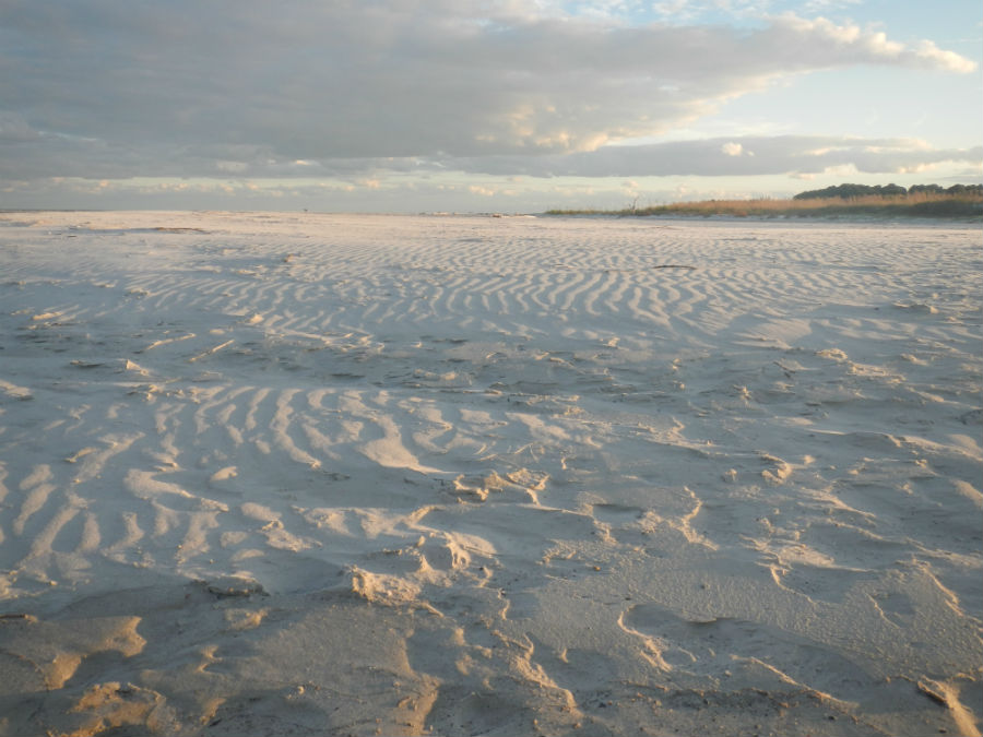
Tearing ourselves away from the beauty of Ocracoke was no small task. It did, however, involve one of our favourite activities of this coastline trip: a ferry ride.

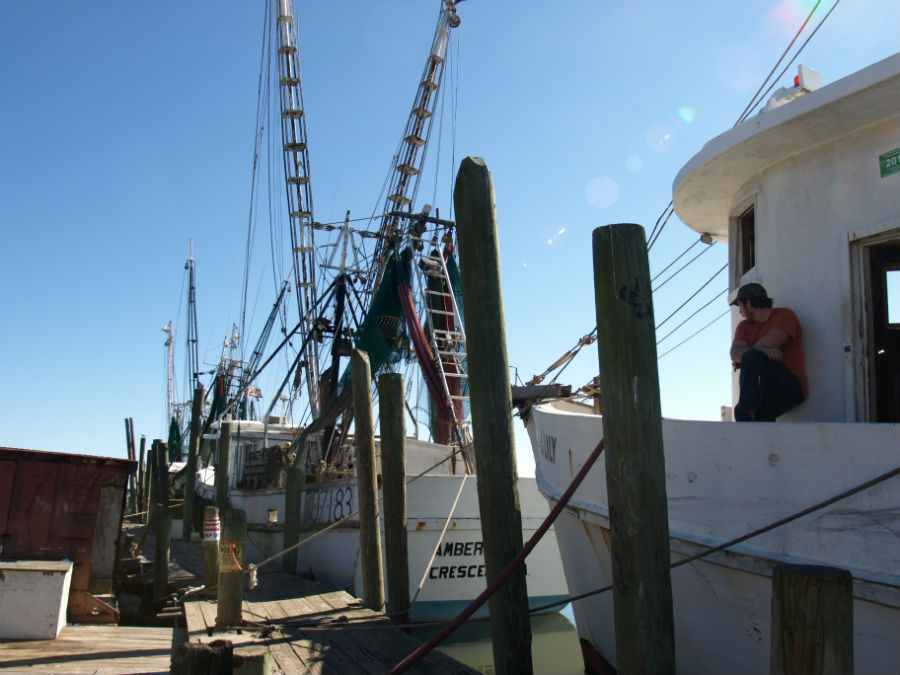
It’s a two-hour ($15 USD) ferry ride across the waters of the Pamlico Sound to Cedar Island on the mainland of North Carolina. The area is better known to locals as Down East – a collection of 13 different maritime communities holding dear to the traditions of the seafaring life. Their past is a colourful history of whaling, fishing, hunting, quilting and the craft of decoy carving.

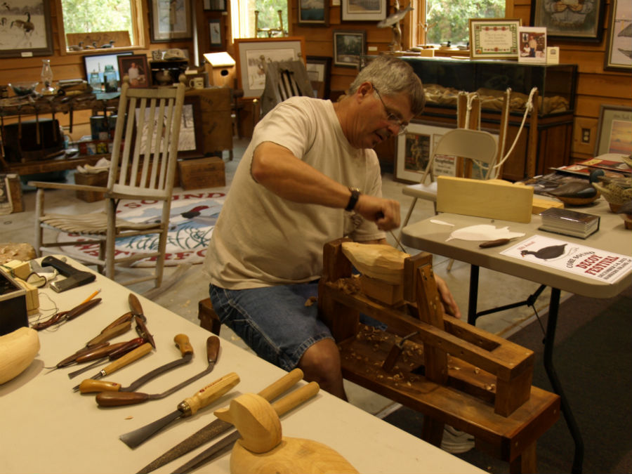
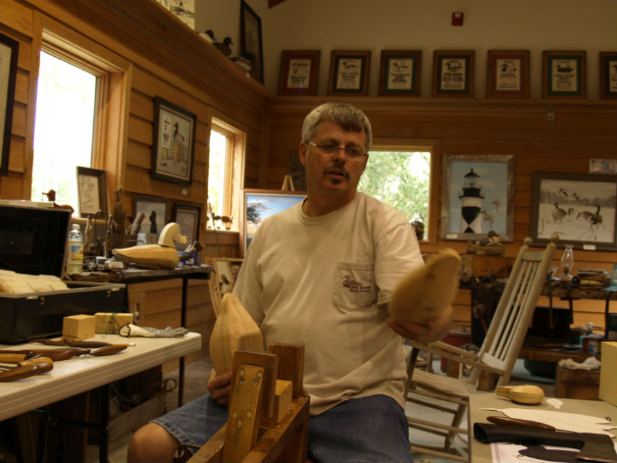
It’s the decoys that drew us to the Core Sound Waterfowl Museum & Heritage Center (right next to the ferry that crosses to the uninhabited shores of Cape Lookout National Seashore). Craig tried his hand at chopping away at a piece of juniper (a wood called white cedar in the north) under the tutelage of an amused Walter “Brother” Gaskill, one of the country’s best decoy carvers.

downeastblog2 downeastblog4

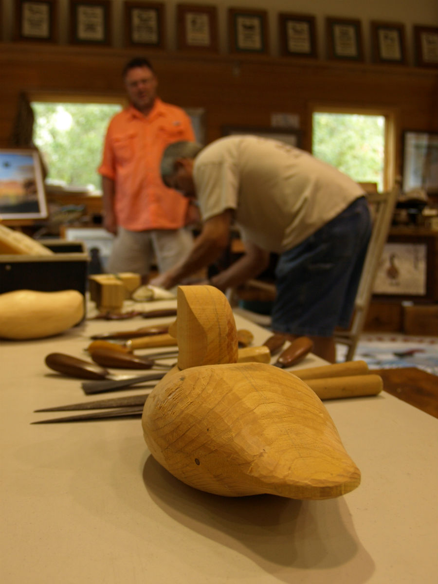
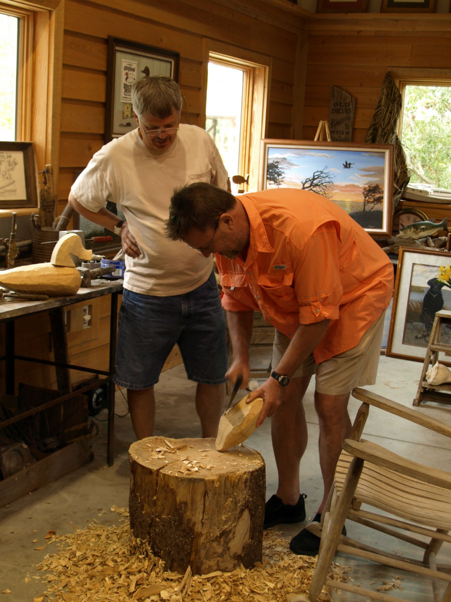
Brother instructed Craig to just chop away anything that “doesn’t look like a duck.” Afterwards Brother pulls out cutting knives and files to try to repair the damage, all the while smiling as he tells us – in a thick Down East brogue – about a local group of carvers who work with the museum to revive the art of carving decoys.

downeastblog8 downeastblog10

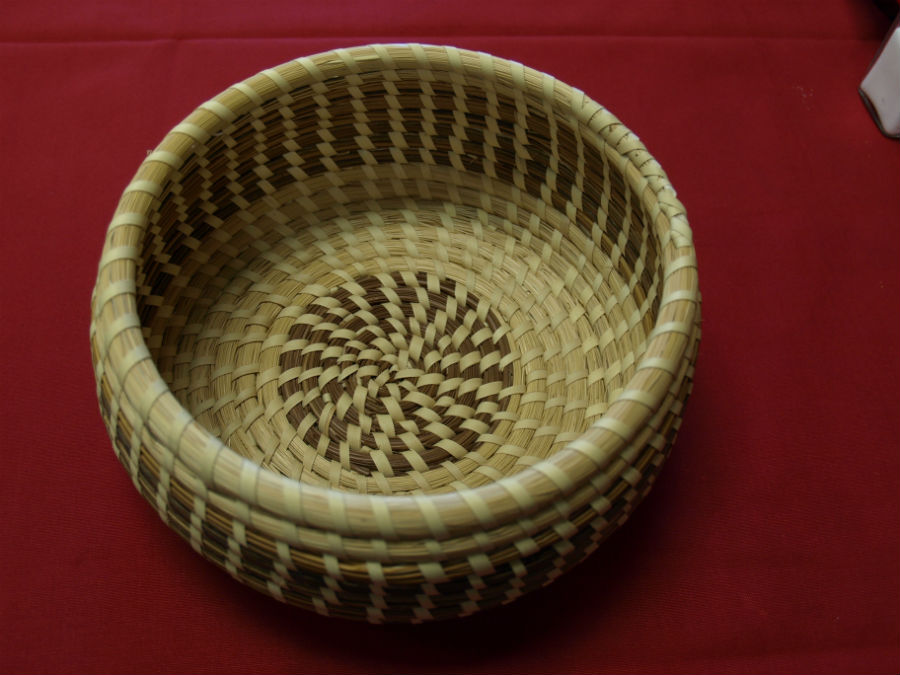
The second level of the museum – a building designed to resemble a cross between a large hunting lodge and a coastal life saving station – is like rummaging through your grandmother’s attic. Displays for each Down East community are filled with duck decoys, handmade quilts, black and white photos and household items.

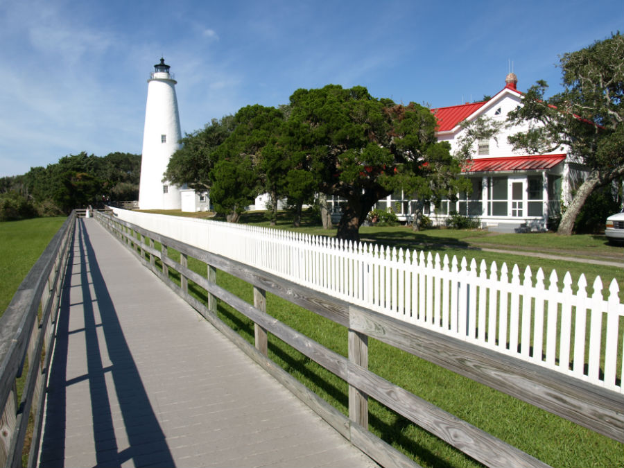
From the top level there is a viewing platform with a great view of the Cape Lookout lighthouse, the only light station in North Carolina that stays lit night and day.

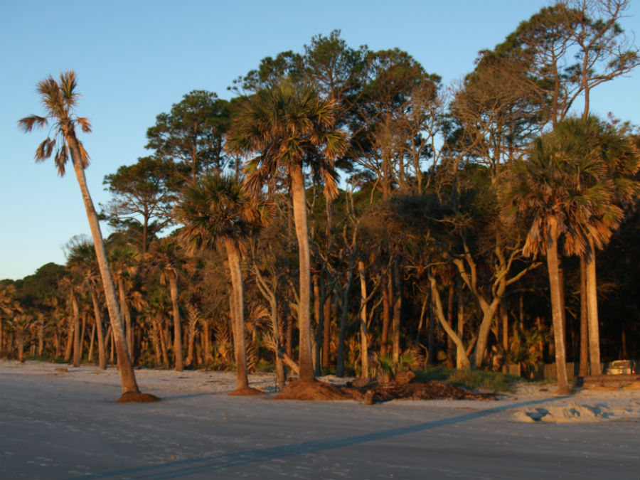
We found more maritime history (and, of course, more on Blackbeard) in the beautiful village of Beaufort (population: 4,000) at the North Carolina Maritime Museum. The region’s proud history of life saving stations, fishing, boatbuilding and piracy (okay, maybe proud is not the right word on that last one) is explained in detail.

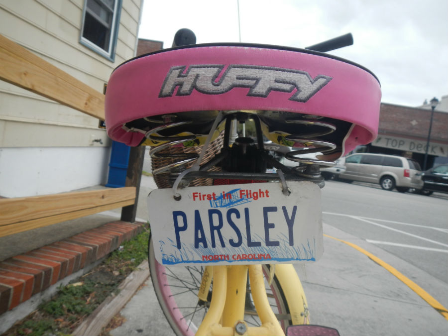
But it was on two wheels that we really discovered the beauty of Beaufort (and it is very beautiful). We pedalled beach bikes from Hungry Town Bike Tours, a local bike tour company run by Betsy and David Cartier, two transplants from the northeast.

downeastblog9 downeastblog5

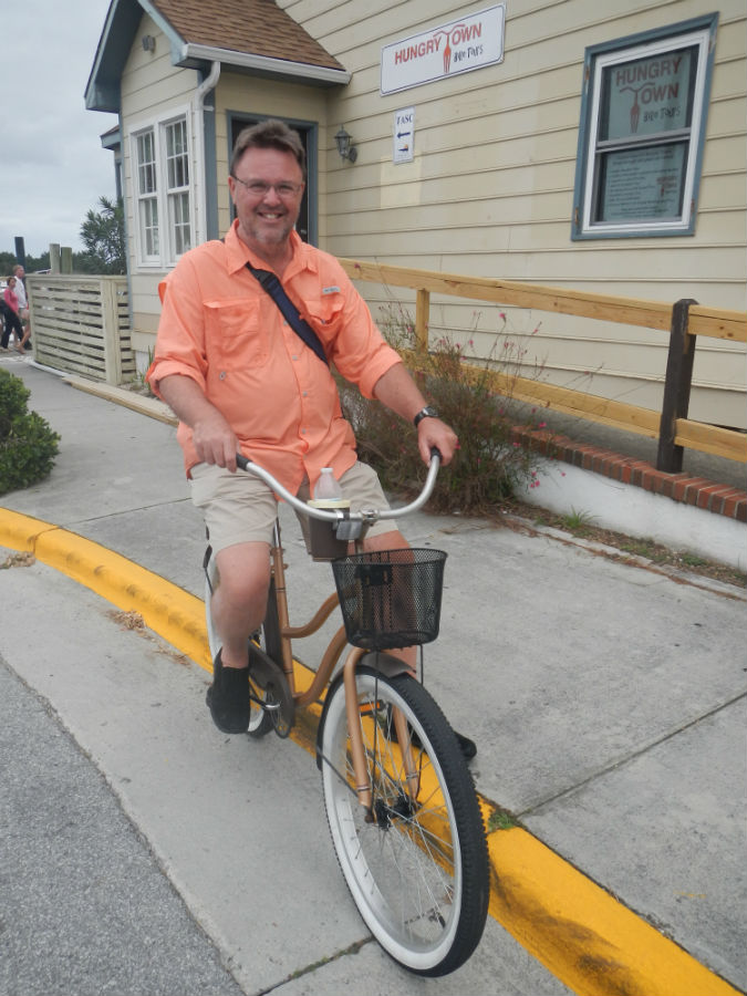
David gave us a snapshot of Beaufort: “OPALs. Older people, active lifestyle.”

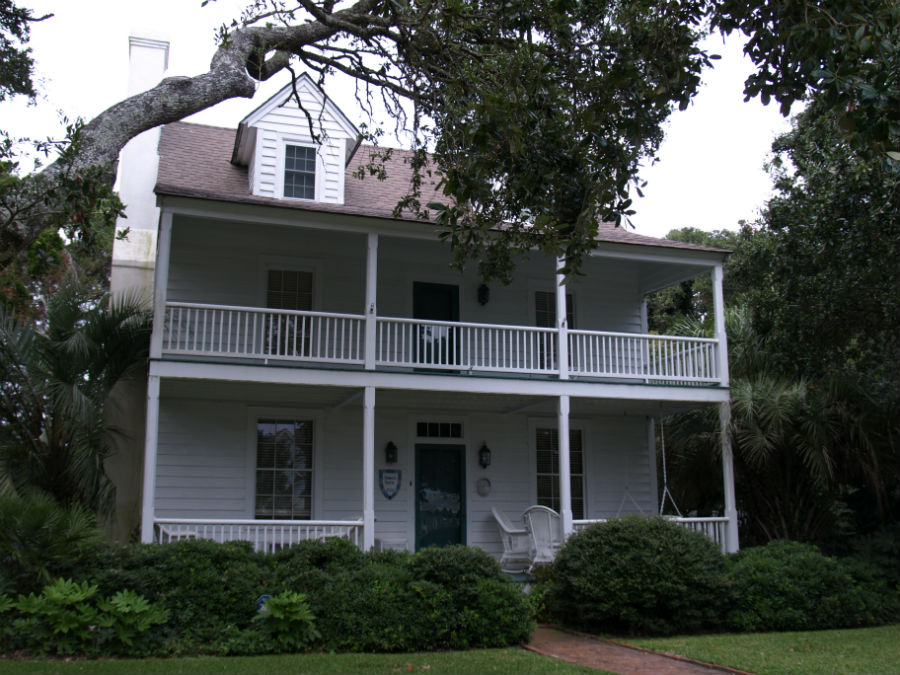
Think a garden club with 160 active members. Wide, quiet streets that are perfect for biking or walking. Gorgeous homes that range from cottages to mansions. A stone’s throw across the harbour is the Rachel Carson Reserve and the historic Fort Macon, a well-preserved Civil War era fort. There are no chain stores in sight.

David has a theory on this. “Beaufort has stayed isolated, so it’s kept its charm. These houses were built by shipbuilders, so they can withstand the storms. You’ll see a lot of homes with two porches – one up and one down – it’s a West Indian style imported by the sailors.”

downeastblog1

Indeed, Beaufort is made for those with a curiosity about history, food and culture and enough zip to pedal around town (easy pedalling along a very flat landscape and very light traffic on the side streets).

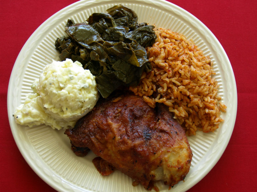
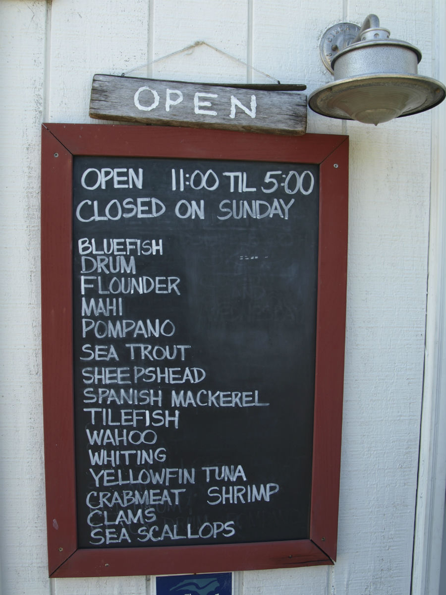
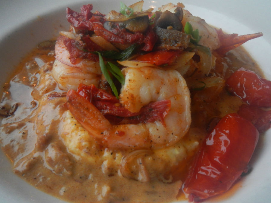
And about that “food” part … After pedalling and sightseeing all day we were primed for finding another seafood meal and, as it turns out, we ate dockside at the Front Street Grill at Stillwater, enjoying meals that were among the best of our trip to date.

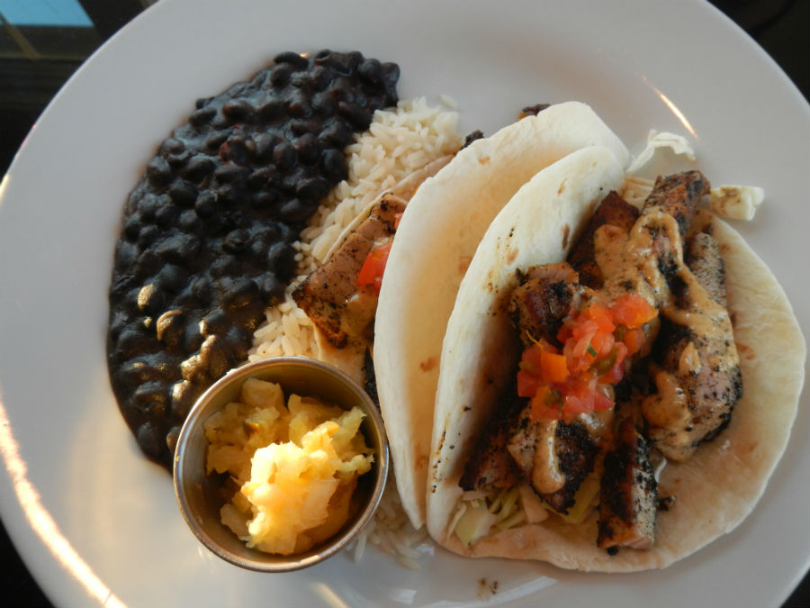
The amazing Shrimp & Grits were made with stone ground cheese grits (flavoured with heavy cream and a sharp Vermont cheddar), sundried tomatoes, mushrooms, onions and tasso (a gravy made from a base of ham drippings). Craig opted for the same-day catch of yellowfin tuna (cooked rare) in soft wheat tortillas and served with sides of black beans, rice and fried plantains. The restaurant has indoor seating, outdoor seating on the deck (dog-friendly) and a great view of the sunset.

downeastblog7

It was a perfect way to end a perfect day!

Ocracoke is a state of mind

Getting to Ocracoke Island means a ferry crossing. And we not so much arrived at the tiny dock at the north tip as we gently slid in – both as a mode of transportation and a mindset.

It took seconds for us to love Ocracoke. There’s an air of instant relaxation. Sure, there’s just one way to get there (ferries at either end). Sure, the NPS campground has no hook-ups and cold water showers. And you won’t hear us complain about the total absence of anything remotely resembling a chain store. Thank goodness.

Ocracoke2

So, what do people do once they get there? Well, they walk on the long strands of deserted beach. They fish. They explore the tiny streets of the island’s one village. They visit the lighthouse and look for the spot where the notorious Blackbeard met his end in 1718. They do a little shopping at the one-of-a-kind artisan shops. They talk to the locals. They eat their weight in fresh seafood.

Ocracoke6

The off-season is the time to come (autumn is when the weather is great – as long as those nuisance hurricanes stay out of the way – and it’s the best time for fishing). Summer can be busy, which is why the village has introduced golf carts as a way of dealing with cars clogging up the historic district’s narrow streets.

Ocracoke5

The setting is spectacular. The seafood couldn’t be fresher. But, it’s really the people of Ocracoke and the rich sense of community that made our visit shine.

It doesn’t take much to pull a story of the families of Ocracoke from Ocracoke Preservation Museum volunteer historian Al Scarborough. “Ocracoke is a very small community. Everyone’s related. The good news is everyone’s related,” he laughs. “The bad news is everyone knows your business.”

It was never really a fishing village, although people think of it that way. It began as an outpost for pilots, the skilled seamen who piloted schooners through the inlet. The pilots and their families were the lifeblood of Ocracoke.

Ocracoke3

The island has seen shifts in its economy. When steam engines came along the need for pilots tanked. People moved to subsistence fishing. Refrigeration was invented and the catch could be stored before being shipped to larger ports. As soon as ferries connected the island to the mainland, tourism trickled in, and rocketed once a reverse osmosis plant in the 1960s meant that small hotels and inns could handle a larger number of guests.

Now, don’t get the idea that all of this growth means high rises and the like. Ocracoke has stayed small and the people like it that way. Flip open a phone book and you’ll still find pages of island family names: Gaskill, Gaskin, Braggs and Howard.

Philip Howard traces his family lineage back to the original purchasers of the island in 1759. Philip is a bit of a local authority on the history of the island and he certainly knows “where the bodies are buried.”

Actually, everyone does. Ocracoke (population: 850) has got more than 80 cemeteries and many families buried ‘em in the backyard.

Standing along the narrow, dirt Howard Street (a back laneway in the village’s historic core), Philip was able to point out a slew of final resting places for his relatives. “My grandparents are buried there,” he points. “And my aunt and uncle over there,” pointing the opposite direction down the lane.

It’s still customary to bury one’s dearly departed in the family’s small, fenced backyard cemetery.

It’s cosy and friendly and comfortable and there’s more than enough to fill your time. We’ve got some suggestions of don’t-miss stops:

  • Ocracoke Light Station – the walls are four-foot thick red brick, plastered and whitewashed. Ocracoke1
  • Springer’s Point is a lovely walk through a mature maritime forest to a stretch of beach where historians believe Blackbeard was based.
  • Rudy Austin’s Austin Boat Tours shuttles fishermen, campers and daytrippers to deserted Portsmouth Island. Rudy, an Ocracoke native, covers birding, history, Blackbeard lore, fishing and dolphin watching.
  • North Carolina native Rob Temple operates charters and tours on the schooner Windfall II and the historic Skipjack Wilma Lee. Rob is an authority on Blackbeard and knows all the answers to all the questions.
  • Places to eat: The Flying Melon Café serves three meals a day, including local favourites like Shrimp Mash (grilled local shrimp with poached eggs, topped with hollandaise). If you’re cooking yourself, the place to get fresh seafood is at the Ocracoke Seafood Co., a local fish house where young fishermen like Morty Gaskill keep the traditions alive. Ocracoke8
  • Overnight stays: You’ll want to stay several days. There are many cottages to rent or you can book hotel suites at Captain’s Landing, right on the dockside with spectacular views of the harbour and the lighthouse. RV and tenters can bed down at the NPS Ocracoke Campground just a few miles north of the village.

Cape Hatteras National Seashore: Where land and sea meet

It would have been a mistake to look at a map of the stretch of barrier islands to the south, turn around and head back north to the comforts of the Outer Banks’ “larger” communities, like Nags Head, Kitty Hawk and Manteo. As lovely as these villages are – and they are great places to visit – things got really interesting the further we drove south into the heart of Cape Hatteras National Seashore.

First, a little geography: Cape Hatteras National Seashore is a long, pencil-thin stretch of barrier islands (Bodie, Hatteras, Ocracoke) with the dunes of the Atlantic Ocean on one side and the water of Pamlico Sound on the other. It’s largely land under the watch of the National Park Service, so gets a high level of environmental protection. There are several historic villages scattered along the way (not part of the NPS land) with large beachfront homes and all the amenities of a smaller town.

OBXsouth1

We’ve already written about the shifting sand and the close watch residents keep through hurricane season (June – November) but the real highlight is what’s not along long stretches of this pristine coast. The NPS has preserved wetlands for migratory birds (hike along a boardwalk at Pea island National Wildlife Refuge), historic lighthouses and miles of remote sand beach.

In the water, dolphins played. On the shoreline, a few fishermen planted their long rods to cast from the surf and the occasional walker doffed footwear and strolled barefoot along the sand. No shops. No go-carts or mini-golf. Not even a single vending machine. In the NPS campgrounds? No electrical hook-ups and cold water showers. Ink-black skies at night. It’s not everyone’s cup of tea but it sure is ours.

The Outer Banks are infamous as the Graveyard of the Atlantic – a testament to the dangerous shoals that claimed many a passing ship (the estimate is the waters off the banks holds more than 600 shipwrecks dating back centuries).

Craig took the ranger-guided hike up the black and white striped Bodie Island Light Station. The view from the top was great over the long dunes and the salt marshes that are a perfect stopover point for birds migrating north-south along the Atlantic Flyway. Bodie Island Lighthouse was built in 1871, is 214 steps and on a clear day you can see 30 km (18 mi) from the top. Its flash pattern is 2.5 on, 2.5 off, 2.5 on, 22.5 off (just in case you were wondering) and it still uses an original Fresnel lens. The grounds of the lighthouse are dog friendly (but not a climb to the top).

OBXsouth3

A little further down the road we stopped at the candy-cane striped lighthouse that most people associate with the Outer Banks: Cape Hatteras Light Station. The National Historic Landmark is the continent’s tallest brick lighthouse (a climb up Hatteras is 248 steps, equivalent to a 12-storey building). The grounds of the lighthouse are dog friendly (but not a climb to the top).

The iconic lighthouse also made it to many a newspaper front page in 1999 when the National Park Service moved the entire brick structure 460 m (1,500 ft) back from an encroaching sea. The sands continue to shift but they say the move should keep the tall building safe for a good long time.

OBXsouth4

In Hatteras Village we ate dinner overlooking a dock filled with fishing boats and had a seafood meal that set the bar high for the remainder of our trip. The chef at the Breakwater Restaurant buys local: shrimp, scallops, grouper, flounder, tuna and it shows in the taste on the plate. We ate our fill of steamed shrimp the size of a toddler’s fist that were flavour-packed, meaty and didn’t suffer a bit from being dipped in melted butter. On a quest to embrace grits, Jo ate a delicious main of Shrimp & Grits (and yes, it did the trick – now a convert) and Craig had spicy, blackened chunks of yellowfin tuna (the catch of the day) wrapped in soft wheat tortillas and served with sides of black beans, rice and a pineapple chutney. Dessert was one slice/two forks of Peanut Butter Pie – a rich and creamy PB centre topped with dark, chocolate ganache.

Breakwater1

Like we said, the bar is set high.

Words on the page

Our stories and articles appear in Canadian magazines and online.

Spring and fall, we load the van – with everything from guitars to laptops – toss in a thick bundle of maps, several notebooks and roll down the road. We meet great people, gather wonderful story material and then write, write, write. Browse the links to some of our pieces in print:

BIG TRIP #1: ROOTS OF AMERICAN MUSIC: 9,000 km through the Southeast U.S.

Music Trails of the American Southeast1

BIG TRIP #2: TUNES, RUINS & STARS: 13,000 km across the American Southwest

American Southwest

BIG TRIP #3: HUGGING THE ATLANTIC COASTLINE; MUSIC INLAND: 7,064 km

Google Maps Big Trip #3 PDF-page-001

BIG TRIP #4: ROCK & ROLL: 10,950 km exploring western U.S. National Parks

 MISCELLANEOUS